IMAGES TAKEN NEAR TO
Harrogate Road, LEEDS, LS17 9JZ
Introduction
This page details the photographs taken nearby to Harrogate Road, LS17 9JZ by members of the Geograph project.
The Geograph project started in 2005 with the aim of publishing, organising and preserving representative images for every square kilometre of Great Britain, Ireland and the Isle of Man.

There are currently over 7.5m images from over14,400 individuals and you can help contribute to the project by visiting https://www.geograph.org.uk
Image Map (11 Images)


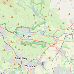
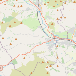
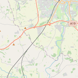

Leaflet Map data © OpenStreetMap
Images are licensed for reuse under creativecommons.org/licenses/by-sa/2.0
Notes
- Clicking on the map will re-center to the selected point.
- The higher the marker number, the further away the image location is from the centre of the postcode.
Image Listing (11 Images Found)
Images are licensed for reuse under creativecommons.org/licenses/by-sa/2.0
Image
Details
Distance
1

Wikefield Farm
A major equestrian centre
Image: © John Slater
Taken: 2 Apr 2015
0.05 miles
2
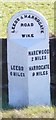
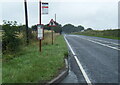
Old Milestone by the A61, Harrogate Road, Harewood
Metal plate attached to stone post by the A61, in parish of HAREWOOD (LEEDS District), Harrogate Road, North of Sturdy Bridge and 250m North of Wikefield Farm entrance opposite, on the verge near 'Slow Queuing Traffic' sign, on South East side of road. West Riding iron casting, erected by the County Council in the 19th century.
Inscription reads:-
: LEEDS / 6 MILES : : LEEDS & HARROGATE / ROAD / WIKE :
: HAREWOOD / 2 MILES / HARROGATE / 9 MILES :
Hole in top.
Grade II Listed. List Entry Number: 1226252
https://historicengland.org.uk/listing/the-list/list-entry/1226252
Milestone Society National ID: YW_LEHG06.
Image: © C Minto
Taken: 1 Aug 2001
0.13 miles
3

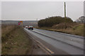
Approaching Harrogate Road near Wikefield Farm
Image: © John Slater
Taken: 2 Apr 2015
0.13 miles
4
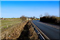
A61 near Wikefield Farm
Section of the Leeds/Harrogate A61 road, approaching a shap corner between Sturdy Bridge and Wikefield Farm
Image: © Chris Heaton
Taken: 24 Jan 2015
0.15 miles
7
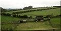
Farmland near Wikefield Farm
A rather gloomy view from the A61, of fields above the Sturdy Brook, lined by the trees on the extreme left.
Image: © Derek Harper
Taken: 3 Jul 2014
0.17 miles
8
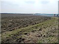
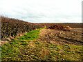
Unploughed field margin
South of the junction of Fortshot Lane and the Harrogate Road.
Image: © Christine Johnstone
Taken: 7 Apr 2013
0.21 miles
9

Unmelted snow along the west side of a hedge
A white tide, the remains of unmelted snowdrifts, south of Fortshot Lane.
Image: © Christine Johnstone
Taken: 7 Apr 2013
0.22 miles
10
Field off Fortshot Lane, Wike
There is a nice heap of manure ready for spreading onto the field.
Image: © Humphrey Bolton
Taken: 12 Mar 2022
0.23 miles