
IMAGES TAKEN NEAR TO
Harrogate Road, LEEDS, LS17 9JA
Introduction
This page details the photographs taken nearby to Harrogate Road, LS17 9JA by members of the Geograph project.
The Geograph project started in 2005 with the aim of publishing, organising and preserving representative images for every square kilometre of Great Britain, Ireland and the Isle of Man.

There are currently over 7.5m images from over14,400 individuals and you can help contribute to the project by visiting https://www.geograph.org.uk
Image Map
Images are licensed for reuse under creativecommons.org/licenses/by-sa/2.0
Notes
- Clicking on the map will re-center to the selected point.
- The higher the marker number, the further away the image location is from the centre of the postcode.
Image Listing (37 Images Found)
Images are licensed for reuse under creativecommons.org/licenses/by-sa/2.0
Image
Details
Distance
1
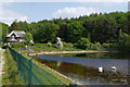
Eccup Reservoir and Reservoir Lodge
In May 2018, Reservoir Lodge was for sale with an asking price of £925,000.
See this link http://www.adairpaxton.co.uk/reservoir-lodge-harrogate-road-leeds for the description by the Estate Agent (Adair Paxton). (It's likely the link will not be valid after the building has been sold).
Image: © Rich Tea
Taken: 28 May 2018
0.01 miles
2

An ornate gate
Plenty of signage accompanies this old ornate gate across the footpath at the easternmost edge of Eccup Reservoir.
Image: © Oxana Maher
Taken: 30 Mar 2021
0.02 miles
3

Never Go In Reservoirs
A sign at the south end of the dam at Eccup Reservoir, and a view west along the length of the reservoir.
For a drier view of the jetty see Image]
To continue on the walk round the reservoir go to Image]
Image: © Rich Tea
Taken: 8 Apr 2007
0.02 miles
4

Eccup Reservoir & Jetty - viewed from Dam
Image: © Betty Longbottom
Taken: 29 Sep 2013
0.03 miles
5

Path by The Lodge and Wigton Knowle
The lodge is at the end of the dam, by Yorkshire Water's road that comes in from the A61 Harrogate Road.
Continue round the reservoir at Image]
Image: © Rich Tea
Taken: 8 Apr 2007
0.03 miles
6
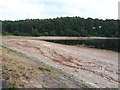
Eccup reservoir in a dry summer
The reservoir had been nearly full on my previous visit only a couple of months earlier Image Comparison with another view from 2013 Image suggests that this is about the level to be expected at the end of the summer, but June 2018 had been exceptionally hot and dry.
Image: © Stephen Craven
Taken: 5 Jul 2018
0.06 miles
7

Woodland path, Wigton Knowle
The path runs parallel to the perimeter path of the reservoir for some distance.
Image: © Stephen Craven
Taken: 29 Apr 2018
0.08 miles
8

Looking across Eccup Reservoir at the dam
From the path alongside Wigton Knowle. The wire fence and bushes made it necessary to hold the camera above my head for this one.
Next go to Image]
Image: © Rich Tea
Taken: 8 Apr 2007
0.09 miles
9
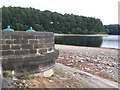
Eccup reservoir - access hatch
A low water level has revealed what appears to be an access hatch to the draw-off tower.
Image: © Stephen Craven
Taken: 5 Jul 2018
0.11 miles
10
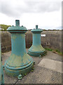
Eccup reservoir - scour valves
The scour pipe is the deepest reservoir drawoff, used either to empty it completely for maintenance, or in an emergency, or to 'scour' the bottom of the reservoir by flushing out accumulated silt. These are now redundant following the completion of the 2015 project (see shared description).
Image: © Stephen Craven
Taken: 29 Apr 2018
0.11 miles