IMAGES TAKEN NEAR TO
Rigton Gardens, LEEDS, LS17 9FB
Introduction
This page details the photographs taken nearby to Rigton Gardens, LS17 9FB by members of the Geograph project.
The Geograph project started in 2005 with the aim of publishing, organising and preserving representative images for every square kilometre of Great Britain, Ireland and the Isle of Man.

There are currently over 7.5m images from over14,400 individuals and you can help contribute to the project by visiting https://www.geograph.org.uk
Image Map
Images are licensed for reuse under creativecommons.org/licenses/by-sa/2.0
Notes
- Clicking on the map will re-center to the selected point.
- The higher the marker number, the further away the image location is from the centre of the postcode.
Image Listing (17 Images Found)
Images are licensed for reuse under creativecommons.org/licenses/by-sa/2.0
Image
Details
Distance
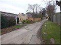
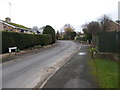
2
Rigton Hall Farm entrance - Wetherby Road
Image: © Betty Longbottom
Taken: 23 Nov 2015
0.06 miles
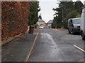
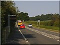
3
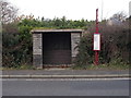
Bus Shelter No LDN 189 - Wetherby Road
Image: © Betty Longbottom
Taken: 23 Nov 2015
0.08 miles
4
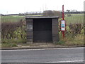
Bus Shelter No LDN 192 - Wetherby Road
Image: © Betty Longbottom
Taken: 23 Nov 2015
0.09 miles
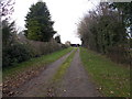
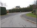
5
Scarsdale Lane - Congreve Approach
Image: © Betty Longbottom
Taken: 23 Nov 2015
0.09 miles
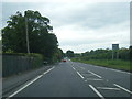
9
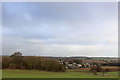
View towards Rigton Hill
Seen from Compton Lane, looking north to an estate beside the A58 between Bardsey and Collingham
Image: © Chris Heaton
Taken: 28 Jan 2016
0.14 miles
10
Fire engine on Wetherby Road
It came past as I was about to take a photo of the milestone across the road.
Image: © Stephen Craven
Taken: 10 Jun 2023
0.15 miles