IMAGES TAKEN NEAR TO
Cornmill Lane, LEEDS, LS17 9EQ
Introduction
This page details the photographs taken nearby to Cornmill Lane, LS17 9EQ by members of the Geograph project.
The Geograph project started in 2005 with the aim of publishing, organising and preserving representative images for every square kilometre of Great Britain, Ireland and the Isle of Man.

There are currently over 7.5m images from over14,400 individuals and you can help contribute to the project by visiting https://www.geograph.org.uk
Image Map
Images are licensed for reuse under creativecommons.org/licenses/by-sa/2.0
Notes
- Clicking on the map will re-center to the selected point.
- The higher the marker number, the further away the image location is from the centre of the postcode.
Image Listing (70 Images Found)
Images are licensed for reuse under creativecommons.org/licenses/by-sa/2.0
Image
Details
Distance
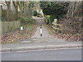
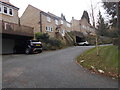
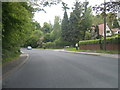
2
Wetherby Road - viewed from Mill Lane
Image: © Betty Longbottom
Taken: 3 Aug 2015
0.08 miles
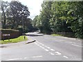
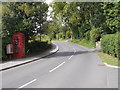
4
Wetherby Road - viewed from Mill Lane
Image: © Betty Longbottom
Taken: 3 Aug 2015
0.08 miles
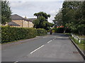
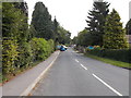
6
Church Lane - viewed from Cornmill Lane
Image: © Betty Longbottom
Taken: 3 Aug 2015
0.09 miles
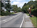
8
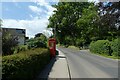
Telephone box on Church Lane
Looking up Church Lane in Bardsey with a phone box and letter box.
Image: © DS Pugh
Taken: 5 Jun 2021
0.10 miles
10
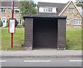
Bus Shelter No LDN 188 - Wetherby Road
Image: © Betty Longbottom
Taken: 3 Aug 2015
0.11 miles