IMAGES TAKEN NEAR TO
Mount Rise, LEEDS, LS17 7QR

Introduction

This page details the photographs taken nearby to Mount Rise, LS17 7QR by members of the Geograph project.

The Geograph project started in 2005 with the aim of publishing, organising and preserving representative images for every square kilometre of Great Britain, Ireland and the Isle of Man.

There are currently over 7.5m images from over14,400 individuals and you can help contribute to the project by visiting https://www.geograph.org.uk

Image Map


Images are licensed for reuse under creativecommons.org/licenses/by-sa/2.0
Notes
  • Clicking on the map will re-center to the selected point.
  • The higher the marker number, the further away the image location is from the centre of the postcode.

Image Listing (43 Images Found)

Images are licensed for reuse under creativecommons.org/licenses/by-sa/2.0
  • ...
Image
Details
Distance
1
Mount Rise - The Fairway
Image: © Betty Longbottom Taken: 5 Oct 2012
0.03 miles
2
Mount Drive - The Fairway
Image: © Betty Longbottom Taken: 5 Oct 2012
0.06 miles
3
Moortown Golf Course - viewed from The Fairway
Image: © Betty Longbottom Taken: 5 Oct 2012
0.06 miles
4
Mount Drive - Alwoodley Lane
Image: © Betty Longbottom Taken: 6 May 2008
0.07 miles
5
Alwoodley Lane, Alwoodley
This view is from the junction with Goodrick Lane.
Image: © Humphrey Bolton Taken: 12 Mar 2022
0.07 miles
6
Alwoodley, 129 Alwoodley Lane
According to the OS benchmark database there is a cutmark on the porch wall to the left of the front door. White masonry paint covers the property and nothing could be seen from the roadside.
Image: © Mel Towler Taken: 3 Oct 2022
0.07 miles
7
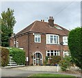
Alwoodley, 21 The Fairway
There is a benchmark cut into the south-west facing wall, and it is directly underneath the white meter box, and to the left of the black drainpipe.
Image: © Mel Towler Taken: 3 Oct 2022
0.08 miles
8
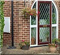
Alwoodley, 21 The Fairway
The benchmark is cut into the south-west facing wall, and it is directly underneath the white meter box.
Image: © Mel Towler Taken: 3 Oct 2022
0.08 miles
9
Alwoodley, Alwoodley Lane, Mount Farm
According to the OS benchmark database there is a cutmark on the roadside wall on the south side of the road. The tick bushes were obscuring a decent view of the wall and nothing could be seen. The wall is old, and it is likely the cutmark still remains.
Image: © Mel Towler Taken: 3 Oct 2022
0.08 miles
10
The Sandmoor Golf Course from Goodrick Lane
This is the view along the southern edge of the course.
Image: © Humphrey Bolton Taken: 12 Mar 2022
0.11 miles
  • ...