IMAGES TAKEN NEAR TO
The Quarry, LEEDS, LS17 7NH
Introduction
This page details the photographs taken nearby to The Quarry, LS17 7NH by members of the Geograph project.
The Geograph project started in 2005 with the aim of publishing, organising and preserving representative images for every square kilometre of Great Britain, Ireland and the Isle of Man.

There are currently over 7.5m images from over14,400 individuals and you can help contribute to the project by visiting https://www.geograph.org.uk
Image Map (Loading...)


Getting Data...Please wait
Leaflet Map data © OpenStreetMap
Images are licensed for reuse under creativecommons.org/licenses/by-sa/2.0
Notes
- Clicking on the map will re-center to the selected point.
- The higher the marker number, the further away the image location is from the centre of the postcode.
Image Listing (70 Images Found)
Images are licensed for reuse under creativecommons.org/licenses/by-sa/2.0
Image
Details
Distance
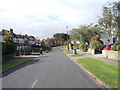
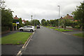
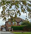
2
Alwoodley Court Gardens - The Drive
Image: © Betty Longbottom
Taken: 5 Oct 2012
0.05 miles
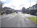
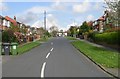
4
Alwoodley Park.
Looking SW down The Avenue, near the junction with The Drive and The Fairway.
Image: © Steve Partridge
Taken: 17 Feb 2006
0.07 miles
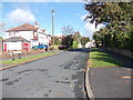
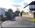
9
Alwoodley, 80 The Avenue
According to the OS benchmark database there is a cutmark on the north-east face of the property. Nothing could be seen from the driveway gate.
Image: © Mel Towler
Taken: 3 Oct 2022
0.08 miles
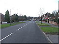
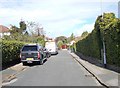
10
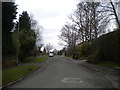
The Drive, Alwoodley
Looking west from close to its east end.
Image: © Richard Vince
Taken: 18 Feb 2017
0.09 miles