IMAGES TAKEN NEAR TO
Garth Road, LEEDS, LS17 5BQ
Introduction
This page details the photographs taken nearby to Garth Road, LS17 5BQ by members of the Geograph project.
The Geograph project started in 2005 with the aim of publishing, organising and preserving representative images for every square kilometre of Great Britain, Ireland and the Isle of Man.

There are currently over 7.5m images from over14,400 individuals and you can help contribute to the project by visiting https://www.geograph.org.uk
Image Map (Loading...)


Getting Data...Please wait
Leaflet Map data © OpenStreetMap
Images are licensed for reuse under creativecommons.org/licenses/by-sa/2.0
Notes
- Clicking on the map will re-center to the selected point.
- The higher the marker number, the further away the image location is from the centre of the postcode.
Image Listing (83 Images Found)
Images are licensed for reuse under creativecommons.org/licenses/by-sa/2.0
Image
Details
Distance
4
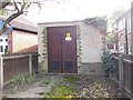
Electricity Substation No 3445 - Stonegate Road
Image: © Betty Longbottom
Taken: 9 Oct 2012
0.05 miles
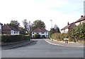
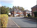
5
Carr Manor Avenue - Carr Manor Road
Image: © Betty Longbottom
Taken: 3 Sep 2012
0.06 miles
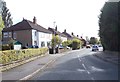
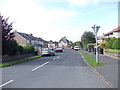
7
Garth Road, off Stonebeck Road
Note the postbox, and the substation in the background (see Image for a closer look).
Image: © Stephen Craven
Taken: 7 Nov 2020
0.06 miles
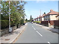
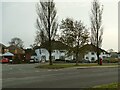
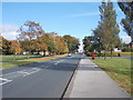
8
Stonegate Road - viewed from Garth Road
Image: © Betty Longbottom
Taken: 9 Oct 2012
0.06 miles
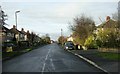
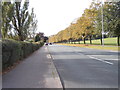
9
Stonegate Road - viewed from Garth Road
Image: © Betty Longbottom
Taken: 9 Oct 2012
0.06 miles