IMAGES TAKEN NEAR TO
Stonegate Road, LEEDS, LS17 5BG
Introduction
This page details the photographs taken nearby to Stonegate Road, LS17 5BG by members of the Geograph project.
The Geograph project started in 2005 with the aim of publishing, organising and preserving representative images for every square kilometre of Great Britain, Ireland and the Isle of Man.

There are currently over 7.5m images from over14,400 individuals and you can help contribute to the project by visiting https://www.geograph.org.uk
Image Map
Images are licensed for reuse under creativecommons.org/licenses/by-sa/2.0
Notes
- Clicking on the map will re-center to the selected point.
- The higher the marker number, the further away the image location is from the centre of the postcode.
Image Listing (77 Images Found)
Images are licensed for reuse under creativecommons.org/licenses/by-sa/2.0
Image
Details
Distance
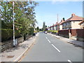
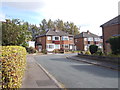
2
Stonegate Road - viewed from Garth Road
Image: © Betty Longbottom
Taken: 9 Oct 2012
0.02 miles
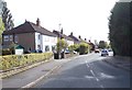
3
Stonegate Road - viewed from Garth Road
Image: © Betty Longbottom
Taken: 9 Oct 2012
0.02 miles
4
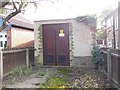
Electricity Substation No 3445 - Stonegate Road
Image: © Betty Longbottom
Taken: 9 Oct 2012
0.03 miles
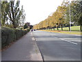
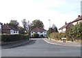
5
Garth Road, off Stonebeck Road
Note the postbox, and the substation in the background (see Image for a closer look).
Image: © Stephen Craven
Taken: 7 Nov 2020
0.03 miles
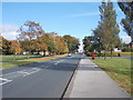
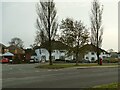
8
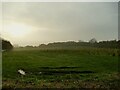
A misty afternoon on King Alfred's Fields
The name of the playing field comes from "King Alfred's Castle", a nearby 18th century folly (now demolished). The view includes some of the 12,500 native trees planted on the site c.2018 in a partnership between the city council, NPower and the charity Trees for Cities.
Image: © Stephen Craven
Taken: 7 Nov 2020
0.06 miles
9
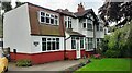
#436 Stonegate Road, 'Greenwood Lea'
Ordnance Survey documents indicate that benchmark levelled at 127.285m was verified in 1957 on the then NE face of the house on which an extension has been added
Image: © Roger Templeman
Taken: 10 Aug 2023
0.07 miles