IMAGES TAKEN NEAR TO
Old Lane, LEEDS, LS16 9HT
Introduction
This page details the photographs taken nearby to Old Lane, LS16 9HT by members of the Geograph project.
The Geograph project started in 2005 with the aim of publishing, organising and preserving representative images for every square kilometre of Great Britain, Ireland and the Isle of Man.

There are currently over 7.5m images from over14,400 individuals and you can help contribute to the project by visiting https://www.geograph.org.uk
Image Map
Images are licensed for reuse under creativecommons.org/licenses/by-sa/2.0
Notes
- Clicking on the map will re-center to the selected point.
- The higher the marker number, the further away the image location is from the centre of the postcode.
Image Listing (25 Images Found)
Images are licensed for reuse under creativecommons.org/licenses/by-sa/2.0
Image
Details
Distance
2
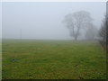
Grazing, Bramhope
Beside Pool Bank New Road.
Image: © JThomas
Taken: 23 Nov 2018
0.07 miles
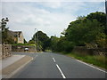
3
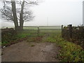
Gated farm track off Pool Bank New Road (A658)
Image: © JThomas
Taken: 23 Nov 2018
0.07 miles
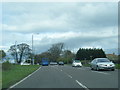
4
Bus stop and shelter on Pool Bank New Road (A658)
Looking north east.
Image: © JThomas
Taken: 23 Nov 2018
0.08 miles
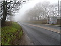
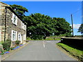
7
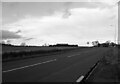
Old Lane approaching Harrogate Road (A658)
Looking eastward.
Image: © Peter Wood
Taken: 1 May 2018
0.11 miles
8
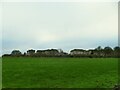
Houses on Hilton Grange
The rear of the houses seen from across a field. They are on the site of a former special school of the same name.
Image: © Stephen Craven
Taken: 28 Dec 2020
0.11 miles
9
Occupation Lane (North)
Occupation Lane entering Old Lane, Bramhope near Leeds
Image: © Chris Heaton
Taken: 4 Sep 2012
0.12 miles