
IMAGES TAKEN NEAR TO
Woodlands Drive, LEEDS, LS16 8GG
Introduction
This page details the photographs taken nearby to Woodlands Drive, LS16 8GG by members of the Geograph project.
The Geograph project started in 2005 with the aim of publishing, organising and preserving representative images for every square kilometre of Great Britain, Ireland and the Isle of Man.

There are currently over 7.5m images from over14,400 individuals and you can help contribute to the project by visiting https://www.geograph.org.uk
Image Map
Images are licensed for reuse under creativecommons.org/licenses/by-sa/2.0
Notes
- Clicking on the map will re-center to the selected point.
- The higher the marker number, the further away the image location is from the centre of the postcode.
Image Listing (138 Images Found)
Images are licensed for reuse under creativecommons.org/licenses/by-sa/2.0
Image
Details
Distance
1
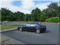
Car park for Lawnswood cemetery
Only official cars and blue badge holders can park in the cemetery itself; other visitors use this car park across the road.
Image: © Stephen Craven
Taken: 14 Jul 2020
0.06 miles
2
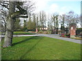
Exit from the Lawnswood Cemetery car park, Adel
The car park is on the opposite side of the road to the entrance to the cemetery, but there are pedestrian traffic lights.
Image: © Humphrey Bolton
Taken: 9 Mar 2019
0.07 miles
3
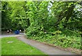
Roadside greenery, A660, Adel, Leeds
According to the OS benchmark database there was a benchmark cut into an office building which was beyond the thick foliage and on the east side of A660. The building has been demolished.
Image: © Mel Towler
Taken: 14 May 2023
0.08 miles
4
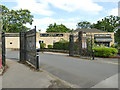
Flower shop and undertakers, Lawnswood cemetery
A firm of funeral directors, with attached flower shop (replacing the one previously in the cemetery, Image ) on the edge of the car park.
Image: © Stephen Craven
Taken: 14 Jul 2020
0.08 miles
5
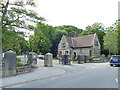
East lodge, Lawnswood cemetery
The lodge at the principal entrance to the cemetery from Otley Road. Built c.1876 as a Registrar's house, architect George Corson, converted and extended in the early 20th century. Listed grade II (List entry 1375316).
Image: © Stephen Craven
Taken: 14 Jul 2020
0.09 miles
6
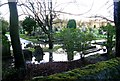
Lawnswood Cemetery under water! - Otley Road
Image: © Betty Longbottom
Taken: 15 Jan 2008
0.11 miles
8
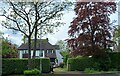
149 Adel Lane, Leeds
According to the OS benchmark database there is a benchmark cut into the north-west face of the property. Nothing could be viewed from the roadside, and it is unknown if the benchmark survives.
Image: © Mel Towler
Taken: 14 May 2023
0.11 miles

10
Esso Filling Station - Otley Road
Image: © Betty Longbottom
Taken: 15 Jan 2008
0.11 miles