
IMAGES TAKEN NEAR TO
Spring Hill, LEEDS, LS16 8EA
Introduction
This page details the photographs taken nearby to Spring Hill, LS16 8EA by members of the Geograph project.
The Geograph project started in 2005 with the aim of publishing, organising and preserving representative images for every square kilometre of Great Britain, Ireland and the Isle of Man.

There are currently over 7.5m images from over14,400 individuals and you can help contribute to the project by visiting https://www.geograph.org.uk
Image Map
Images are licensed for reuse under creativecommons.org/licenses/by-sa/2.0
Notes
- Clicking on the map will re-center to the selected point.
- The higher the marker number, the further away the image location is from the centre of the postcode.
Image Listing (32 Images Found)
Images are licensed for reuse under creativecommons.org/licenses/by-sa/2.0
Image
Details
Distance
1
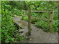
Footbridge across the Adel Beck at Spring Hill
Image: © Stephen Craven
Taken: 5 Jul 2020
0.08 miles
3
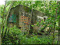
Remains of the toilet block in Adel Woods
There was a natural spring near here Image, around which, according to the information board on site, a small collection of buildings grew up in the 19th century including a flax mill on the nearby stream. After the mill closed, a tea shop was opened for walkers in the woods in 1901. This now-disused toilet block was added to the tea shop in 1954 (from a discussion on secretleeds.com) and is the only building still standing on the site. An older man we met nearby said he remembered using the toilets when they were still in use, but I haven't found a date for their closure.
Image: © Stephen Craven
Taken: 5 Jul 2020
0.11 miles
4
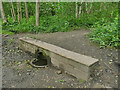
The 'Slabbering Baby' in Adel Woods
There was a natural spring here, around which a small collection of buildings grew up in the 19th century including a flax mill on the nearby stream. After the mill closed, a tea shop was opened for walkers in the woods in 1901, and the spring was channelled into a drinking fountain. An old photo reproduced on the information board shows that it was originally set into a stone wall about a metre above ground level. The present ground level is somewhat higher, perhaps from demolition rubble as all the former buildings but one have been demolished. The fountain was restored by volunteer labour in 2017 but would be very difficult to drink from now.
Image: © Stephen Craven
Taken: 5 Jul 2020
0.11 miles
5
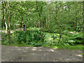
Former mill pond in Adel Woods
According to an information board on site, the pond and its several feeder channels was constructed in the 1840s at the expense of the Leeds Water Works Company to supply a nearby flax mill, as their construction of the water tunnel and aqueduct through the woods was likely to interfere with the stream that had originally powered the mill.
Image: © Stephen Craven
Taken: 5 Jul 2020
0.12 miles
6
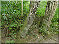
Ruined wall by Nanny Beck
There was a natural spring here Image, around which a small collection of buildings grew up in the 19th century including a flax mill on the nearby stream. After the mill closed, a tea shop was opened for walkers in the woods in 1901. This wall may be a remnant of the tea shop, or one of the other buildings in the group.
Image: © Stephen Craven
Taken: 5 Jul 2020
0.12 miles
7
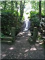
Stone Footbridge in Adel Woods
Old stone gateposts and footbridge on the Dales Way in Adel Woods.
Image: © John S Turner
Taken: 23 Jul 2004
0.12 miles
8
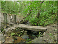
Clapper bridge over Nanny Beck
The bridge probably dates from the time the nearby flax mill was operational (mid-late 19th century) and the path across it now forms part of the Dales Way link.
Image: © Stephen Craven
Taken: 5 Jul 2020
0.13 miles
9
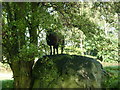
I'm the King of the castle
A sheep hiding in the trees.
Image: © Ian S
Taken: 2 Oct 2010
0.17 miles
