
IMAGES TAKEN NEAR TO
LS16 6TJ
Introduction
This page details the photographs taken nearby to LS16 6TJ by members of the Geograph project.
The Geograph project started in 2005 with the aim of publishing, organising and preserving representative images for every square kilometre of Great Britain, Ireland and the Isle of Man.

There are currently over 7.5m images from over14,400 individuals and you can help contribute to the project by visiting https://www.geograph.org.uk
Image Map
Images are licensed for reuse under creativecommons.org/licenses/by-sa/2.0
Notes
- Clicking on the map will re-center to the selected point.
- The higher the marker number, the further away the image location is from the centre of the postcode.
Image Listing (55 Images Found)
Images are licensed for reuse under creativecommons.org/licenses/by-sa/2.0
Image
Details
Distance
1
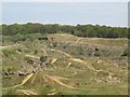
Former Woodside Quarry, looking north--east
There have been stone and sand quarries in this area for a very long time but this must have been extensive 20th century expansion. I have not been able to find out when operations ceased, but at least ten years ago since documents available online record a proposed housing development (complete with new railway station) that never happened.
Image: © Stephen Craven
Taken: 8 May 2016
0.06 miles
2
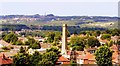
Clayton Woods, Woodside Quarries, Ireland Wood, Leeds
Image: © Mark Stevenson
Taken: 17 Jul 2014
0.06 miles
3
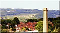
Clayton Woods, Woodside Quarries, Ireland Wood, Leeds
Image: © Mark Stevenson
Taken: 17 Jul 2014
0.06 miles
4

Play space beside Clayton Wood Road
New houses still under construction against the far hillside.
Image: © David Martin
Taken: 5 Apr 2025
0.07 miles
5
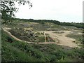
Woodside Quarry, Ireland Wood, Leeds
A wider view of Image]
Image: © Rich Tea
Taken: 26 May 2008
0.07 miles
6
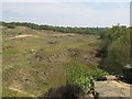
Former Woodside Quarry, looking south-east
There have been stone and sand quarries in this area for a very long time but this must have been extensive 20th century expansion. I have not been able to find out when operations ceased, but at least ten years ago since documents available online record a proposed housing development (complete with new railway station) that never happened.
Image: © Stephen Craven
Taken: 8 May 2016
0.07 miles
7
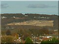
Woodside Quarry from across the Aire valley
This view from the top of Bramley Park shows the extent of the former quarry, which is the largest open space in the area at around 11 hectares. See Image for a closer view from the edge of the quarry.
Image: © Stephen Craven
Taken: 22 Nov 2021
0.08 miles
8
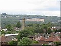
A view across the Aire
From Beecroft Hill to the very stark clearing that is Woodside Quarry.
Image: © Richard Webb
Taken: 22 May 2022
0.09 miles
9
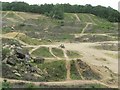
Woodside Quarry, Ireland Wood, Leeds
This quarry used to provide sandstone and gravel. Its now a favoured spot for motorbikes.
There was a plan to develop it for housing etc, together with a new station on the railway line beside it, and a Park and Ride scheme, but that is currently on hold.
Image: © Rich Tea
Taken: 26 May 2008
0.10 miles
10

New housing development seen across railway cutting
Image: © David Martin
Taken: 5 Apr 2025
0.12 miles