
IMAGES TAKEN NEAR TO
Aspen Mount, LEEDS, LS16 6RT
Introduction
This page details the photographs taken nearby to Aspen Mount, LS16 6RT by members of the Geograph project.
The Geograph project started in 2005 with the aim of publishing, organising and preserving representative images for every square kilometre of Great Britain, Ireland and the Isle of Man.

There are currently over 7.5m images from over14,400 individuals and you can help contribute to the project by visiting https://www.geograph.org.uk
Image Map
Images are licensed for reuse under creativecommons.org/licenses/by-sa/2.0
Notes
- Clicking on the map will re-center to the selected point.
- The higher the marker number, the further away the image location is from the centre of the postcode.
Image Listing (63 Images Found)
Images are licensed for reuse under creativecommons.org/licenses/by-sa/2.0
Image
Details
Distance


6
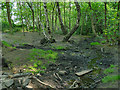
Stream in Spring Wood
Almost dry after weeks without appreciable rainfall.
Image: © Stephen Craven
Taken: 15 May 2020
0.07 miles
7
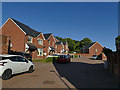
Oak Park Close
The housing estate has been built in recent years in the grounds of the former Cookridge Hospital.
Image: © Stephen Craven
Taken: 15 May 2020
0.07 miles
8

Footpath along the western edge of Woodside Quarry, Cookridge
Image: © Humphrey Bolton
Taken: 9 Mar 2019
0.07 miles
9
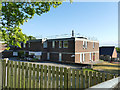
Public Health England, Oak Park Close, Cookridge
There is a sign from Silk Mill Way pointing to "Public Health England" that must refer to this building, so it's not a secret location although there's no signage at the gate. A little online research shows it's the home of Public Health England's CRCE Radiation Protection Division.
Image: © Stephen Craven
Taken: 15 May 2020
0.09 miles
10

Regenerated woodland in the disused Woodside Quarry, Cookridge
This was Clayton Wood before the land was quarried.
Image: © Humphrey Bolton
Taken: 9 Mar 2019
0.10 miles