
IMAGES TAKEN NEAR TO
Wynford Avenue, LEEDS, LS16 6JW
Introduction
This page details the photographs taken nearby to Wynford Avenue, LS16 6JW by members of the Geograph project.
The Geograph project started in 2005 with the aim of publishing, organising and preserving representative images for every square kilometre of Great Britain, Ireland and the Isle of Man.

There are currently over 7.5m images from over14,400 individuals and you can help contribute to the project by visiting https://www.geograph.org.uk
Image Map
Images are licensed for reuse under creativecommons.org/licenses/by-sa/2.0
Notes
- Clicking on the map will re-center to the selected point.
- The higher the marker number, the further away the image location is from the centre of the postcode.
Image Listing (64 Images Found)
Images are licensed for reuse under creativecommons.org/licenses/by-sa/2.0
Image
Details
Distance
1
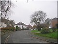
The Grange Road - looking towards Otley Old Road
Image: © Betty Longbottom
Taken: 14 Nov 2011
0.05 miles
3
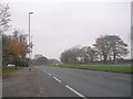
Otley Road - viewed from Otley Old Road
Image: © Betty Longbottom
Taken: 14 Nov 2011
0.10 miles
4
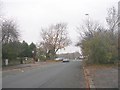
Otley Old Road - viewed from The Grange Road
Image: © Betty Longbottom
Taken: 14 Nov 2011
0.10 miles
5
Benchmark cut into milestone
The benchmark is cut into the east face of the milestone. Only the datum line and the extreme tip of the arrowhead is on view. The remainder of the cutmark has been hidden by layers of pavement tarmac. Wider view Image]
Image: © Mel Towler
Taken: 14 May 2023
0.11 miles
6

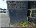
Old milestone
Looking across the A660 dual carriageway, Otley Road, the legends on the left face of this stone can be clearly seen. Several similar stones north of here have a mileage to a railway station.
Milestone Society ID - YW_LEOT04a
Image: © Chris Minto
Taken: 24 Aug 2025
0.11 miles
7

Old milestone
This stone is at the junction of Otley Old Road with the A660. It is one of several similar stones north of this junction that have been painted recently by the members of Headingley Rotary Club. The legends on the right face are HEADINGLY CHURCH 1.6/ LEEDS BRIDGE 4.3/ ADEL CHURCH 1.2/ BRAMHOPE CH 3.6/ OTLEY CH 7/ BURLEY CH 10/ ILKLEY CH 13.
Milestone Society ID - YW_LEOT04a
Image: © Chris Minto
Taken: 24 Aug 2025
0.11 miles
8
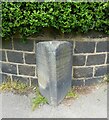
Milestone at junction of Otley Road and Otley Old Road, Adel, Leeds
There is a benchmark cut into the east face of the milestone. Only the datum line and the extreme tip of the arrowhead is on view. The remainder of the cutmark has been hidden by layers of pavement tarmac. Closer view Image]
Image: © Mel Towler
Taken: 14 May 2023
0.11 miles
9
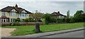
Stone post, Otley Old Road, Lawnswood
There is a benchmark cut into the lone, stone post which is stood on the west side of Otley Old Road, Lawnswood, Leeds.
Image: © Mel Towler
Taken: 14 May 2023
0.11 miles
10
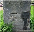
Benchmark cut into lone standing stone post, Lawnswood
The benchmark is cut into a stone post which is stood on the west side of Otley Old Road, Lawnswood, Leeds.
Image: © Mel Towler
Taken: 14 May 2023
0.11 miles