
IMAGES TAKEN NEAR TO
Iveson Wood Rise, LEEDS, LS16 6FE
Introduction
This page details the photographs taken nearby to Iveson Wood Rise, LS16 6FE by members of the Geograph project.
The Geograph project started in 2005 with the aim of publishing, organising and preserving representative images for every square kilometre of Great Britain, Ireland and the Isle of Man.

There are currently over 7.5m images from over14,400 individuals and you can help contribute to the project by visiting https://www.geograph.org.uk
Image Map
Images are licensed for reuse under creativecommons.org/licenses/by-sa/2.0
Notes
- Clicking on the map will re-center to the selected point.
- The higher the marker number, the further away the image location is from the centre of the postcode.
Image Listing (77 Images Found)
Images are licensed for reuse under creativecommons.org/licenses/by-sa/2.0
Image
Details
Distance
4
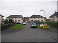
Luttrell Gardens - Luttrell Crescent
Image: © Betty Longbottom
Taken: 14 Nov 2011
0.06 miles
5
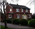
Holy Name Presbytery - Otley Old Road
Image: © Betty Longbottom
Taken: 15 Jan 2008
0.06 miles
6
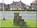
Steps
Horse-climbing steps on Otley Old Road
Image: © vad falcone
Taken: 30 Sep 2007
0.06 miles
7
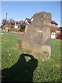
Old milestone
This milestone from the turnpike era is on an open area just north of New Adel Lane on the north side of Otley Old Road. Although there is some damage and delamination the legends are clear. To/Leeds/4/Miles on the front with To/Otley/6/Miles on the slightly angled right-hand side. The colour near the base suggests that the stone may have been set more deeply at one time. Don Cole in his 'Tracks and Roads in a Yorkshire Parish' suggests it may have been a short distance from its present site at the top of Spen Lane.
Image: © Chris Minto
Taken: 6 Nov 2011
0.06 miles
8

Old milestone
An end view of the 4 step milestone on Otley Old Road near New Adel Lane. The legend reads - To/Otley/6/Miles.
Milestone Society ID - YW_OTLE06
Image: © Chris Minto
Taken: 24 Aug 2025
0.06 miles
9

Old milestone
This milestone is on the original main route to Otley now superceded by the A660. Six of these 'step stones' remain by the roadside on this old toll road. The turnpike lasted from 1755 until 1873. This stone is on a wide grass verge near the junction with New Adel Lane. On this face is inscribed To/Leeds/4/Miles. This is one of two that still have 4 steps above ground level. The other four only have 3. It has been moved a short distance from its original site at SE 264 388.
Milestone ID - YW_OTLE06
Image: © Chris Minto
Taken: 24 Aug 2025
0.06 miles
10
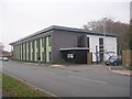
Ireland Wood Surgery - viewed from Iveson Approach
Image: © Betty Longbottom
Taken: 14 Nov 2011
0.06 miles