IMAGES TAKEN NEAR TO
Whinfield, LEEDS, LS16 6AB
Introduction
This page details the photographs taken nearby to Whinfield, LS16 6AB by members of the Geograph project.
The Geograph project started in 2005 with the aim of publishing, organising and preserving representative images for every square kilometre of Great Britain, Ireland and the Isle of Man.

There are currently over 7.5m images from over14,400 individuals and you can help contribute to the project by visiting https://www.geograph.org.uk
Image Map
Images are licensed for reuse under creativecommons.org/licenses/by-sa/2.0
Notes
- Clicking on the map will re-center to the selected point.
- The higher the marker number, the further away the image location is from the centre of the postcode.
Image Listing (61 Images Found)
Images are licensed for reuse under creativecommons.org/licenses/by-sa/2.0
Image
Details
Distance
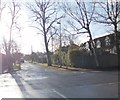
3
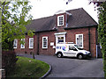
Telephone exchange
This building was designed to mimic a suburban home.
Image: © vad falcone
Taken: 6 Oct 2007
0.08 miles
4
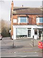
Acorns-in-Adel Private Day Nursery - Otley Road
Image: © Betty Longbottom
Taken: 15 Jan 2008
0.09 miles
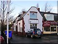
10
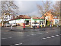
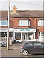
The co-operative food - Otley Road
Image: © Betty Longbottom
Taken: 12 Dec 2011
0.11 miles