IMAGES TAKEN NEAR TO
Northolme Avenue, LEEDS, LS16 5JB
Introduction
This page details the photographs taken nearby to Northolme Avenue, LS16 5JB by members of the Geograph project.
The Geograph project started in 2005 with the aim of publishing, organising and preserving representative images for every square kilometre of Great Britain, Ireland and the Isle of Man.

There are currently over 7.5m images from over14,400 individuals and you can help contribute to the project by visiting https://www.geograph.org.uk
Image Map
Images are licensed for reuse under creativecommons.org/licenses/by-sa/2.0
Notes
- Clicking on the map will re-center to the selected point.
- The higher the marker number, the further away the image location is from the centre of the postcode.
Image Listing (110 Images Found)
Images are licensed for reuse under creativecommons.org/licenses/by-sa/2.0
Image
Details
Distance
1
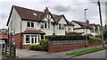
Houses on Northolme Avenue
There is an Ordnance Survey benchmark Image on the near corner of the left hand house beside a brown downpipe
Image: © Roger Templeman
Taken: 6 May 2023
0.01 miles
2
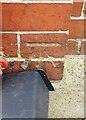
Benchmark on #5 Northolme Avenue
Ordnance Survey cut mark benchmark levelled at 110.953m above Newlyn Datum verified 1957
Image: © Roger Templeman
Taken: 6 May 2023
0.03 miles
3
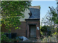
The House of Death, Harrowby Road
What looks like an abandoned house has a "danger of death" sign by the porch.
However it is actually an electrical substation; some of the plant is outdoors Image A site visitor reports that it was being demolished in July 2021. It was certainly an unusual form of construction for a building with this function with its domestic style porch and door, and upstairs room with window.
Image: © Stephen Craven
Taken: 11 May 2020
0.04 miles
4
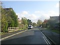
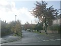
Welburn Avenue - viewed from Northolme Avenue
Image: © Betty Longbottom
Taken: 1 Nov 2011
0.04 miles
6
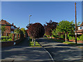
Copper beech trees, Helmsley Road
A few of these on one side of the road have been neatly trimmed, probably by residents rather than the Council as others have been left to grow naturally. See also Image
Image: © Stephen Craven
Taken: 11 May 2020
0.05 miles
7
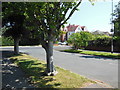
Helmsley Road, West Park
The large building in the centre was once an old people's home but has now been made into flats.
Image: © HelenK
Taken: 7 Jul 2013
0.05 miles
9
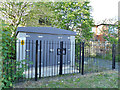
Harrowby Road substation
A modern electrical substation in the grounds of an apparently abandoned house Image
Image: © Stephen Craven
Taken: 11 May 2020
0.05 miles