IMAGES TAKEN NEAR TO
Garland Drive, LEEDS, LS15 9AT
Introduction
This page details the photographs taken nearby to Garland Drive, LS15 9AT by members of the Geograph project.
The Geograph project started in 2005 with the aim of publishing, organising and preserving representative images for every square kilometre of Great Britain, Ireland and the Isle of Man.

There are currently over 7.5m images from over14,400 individuals and you can help contribute to the project by visiting https://www.geograph.org.uk
Image Map
Images are licensed for reuse under creativecommons.org/licenses/by-sa/2.0
Notes
- Clicking on the map will re-center to the selected point.
- The higher the marker number, the further away the image location is from the centre of the postcode.
Image Listing (113 Images Found)
Images are licensed for reuse under creativecommons.org/licenses/by-sa/2.0
Image
Details
Distance
2
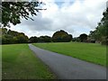
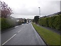
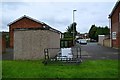
Cycle route through Whitkirk
Part of the City Connect network, it is 4 miles to Leeds city centre from here, on mostly traffic-free paths.
Image: © Stephen Craven
Taken: 1 Oct 2022
0.04 miles
4
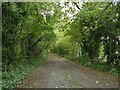
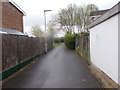
The old alignment of Colton Lane
This is now just a footpath. The present line of Colton Lane leads towards the Skyliner Roundabout.
Image: © Stephen Craven
Taken: 1 Oct 2022
0.06 miles