IMAGES TAKEN NEAR TO
Bramham Gardens, LS15 8GT
Introduction
This page details the photographs taken nearby to Bramham Gardens, LS15 8GT by members of the Geograph project.
The Geograph project started in 2005 with the aim of publishing, organising and preserving representative images for every square kilometre of Great Britain, Ireland and the Isle of Man.

There are currently over 7.5m images from over14,400 individuals and you can help contribute to the project by visiting https://www.geograph.org.uk
Image Map
Images are licensed for reuse under creativecommons.org/licenses/by-sa/2.0
Notes
- Clicking on the map will re-center to the selected point.
- The higher the marker number, the further away the image location is from the centre of the postcode.
Image Listing (69 Images Found)
Images are licensed for reuse under creativecommons.org/licenses/by-sa/2.0
Image
Details
Distance
1
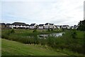
Pools near Barrington Way
New housing constructed to the south of the railway lines between Leeds and Selby.
Image: © DS Pugh
Taken: 3 Aug 2024
0.02 miles
2
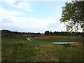
Thorpe Park residential development (3)
Beyond the pond, groundworks are underway in preparation for an infill development of 300 new housing units as part of the Thorpe Park masterplan. These will occupy the space between the existing retail, leisure and commercial development at Thorpe Park and the railway line. Redrow is the developer. A linear green space known as Central Park will incorporate the existing ponds (one of which is seen here).
Image: © Stephen Craven
Taken: 9 Oct 2019
0.02 miles
3
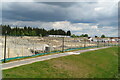
New housing development, Thorpe park
New housing development adjoining Springs retail park. It marks the border of the former Barnbow Munitions site, now also a housing estate. The Leeds to Garforth railway line runs behind it, and there used to have a level crossing. There have been proposals to site a new railway station in the vicinity
Image: © Oxana Maher
Taken: 2 May 2020
0.04 miles
4
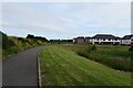
Path at the western end of the pools
New housing constructed to the south of the railway lines between Leeds and Selby and east of Green Park.
Image: © DS Pugh
Taken: 3 Aug 2024
0.05 miles

6
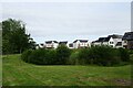
Pools near Harewood Croft
New housing constructed to the south of the railway lines between Leeds and Selby.
Image: © DS Pugh
Taken: 3 Aug 2024
0.07 miles

9

Public Footpath heading South West to Austhorpe Lane
The footpath follows the hedge
Image: © Chris Heaton
Taken: 15 Feb 2019
0.11 miles