IMAGES TAKEN NEAR TO
Manston Lane, LEEDS, LS15 8AE
Introduction
This page details the photographs taken nearby to Manston Lane, LS15 8AE by members of the Geograph project.
The Geograph project started in 2005 with the aim of publishing, organising and preserving representative images for every square kilometre of Great Britain, Ireland and the Isle of Man.

There are currently over 7.5m images from over14,400 individuals and you can help contribute to the project by visiting https://www.geograph.org.uk
Image Map (Loading...)


Getting Data...Please wait
Leaflet Map data © OpenStreetMap
Images are licensed for reuse under creativecommons.org/licenses/by-sa/2.0
Notes
- Clicking on the map will re-center to the selected point.
- The higher the marker number, the further away the image location is from the centre of the postcode.
Image Listing (69 Images Found)
Images are licensed for reuse under creativecommons.org/licenses/by-sa/2.0
Image
Details
Distance
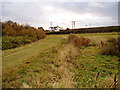
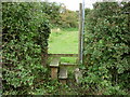
3
A walk from Oulton Church #35
I hope the fence is high enough to stop the lion's from escaping.
Image: © Ian S
Taken: 14 Aug 2010
0.09 miles
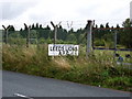
4
Trackbed of old railway
This is part of the trackbed of the railway that served the old World war 1 munitions factory
Image: © Derek Mowbray
Taken: 1 Nov 2003
0.12 miles
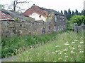
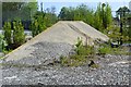
5

Vickers Tank Factory, Crossgates, Leeds
Image: © Mark Stevenson
Taken: 12 May 2016
0.12 miles
6
A walk from Oulton Church #36
Over the stile and into the fields.
Image: © Ian S
Taken: 14 Aug 2010
0.15 miles
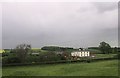
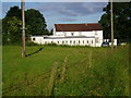
8

Lazencroft Farm
Lazencroft Farm converted for residential use
Image: © Derek Mowbray
Taken: 27 Jun 2012
0.15 miles
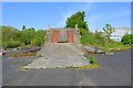
9
Vickers Tank Factory, Crossgates, Leeds
Image: © Mark Stevenson
Taken: 12 May 2016
0.15 miles
10
Vickers Tank Factory, Crossgates, Leeds
Image: © Mark Stevenson
Taken: 12 May 2016
0.15 miles