IMAGES TAKEN NEAR TO
Selby Road, LEEDS, LS15 7TB
Introduction
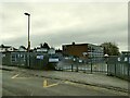
This page details the photographs taken nearby to Selby Road, LS15 7TB by members of the Geograph project.
The Geograph project started in 2005 with the aim of publishing, organising and preserving representative images for every square kilometre of Great Britain, Ireland and the Isle of Man.

There are currently over 7.5m images from over14,400 individuals and you can help contribute to the project by visiting https://www.geograph.org.uk
Image Map
Images are licensed for reuse under creativecommons.org/licenses/by-sa/2.0
Notes
- Clicking on the map will re-center to the selected point.
- The higher the marker number, the further away the image location is from the centre of the postcode.
Image Listing (114 Images Found)
Images are licensed for reuse under creativecommons.org/licenses/by-sa/2.0
Image
Details
Distance
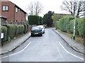
2
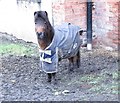
Braving the Cold! - off School Lane
Image: © Betty Longbottom
Taken: 27 Jan 2015
0.04 miles
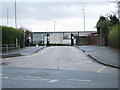

10
Templenewsam Halton Primary School, Pinfold Lane
The school now occupies modern buildings on Pinfold Lane, replacing the original 1842 school building on Selby Road (now grade II listed).
Image: © Stephen Craven
Taken: 1 Jan 2021
0.09 miles