IMAGES TAKEN NEAR TO
Wilfred Avenue, LEEDS, LS15 7SP
Introduction
This page details the photographs taken nearby to Wilfred Avenue, LS15 7SP by members of the Geograph project.
The Geograph project started in 2005 with the aim of publishing, organising and preserving representative images for every square kilometre of Great Britain, Ireland and the Isle of Man.

There are currently over 7.5m images from over14,400 individuals and you can help contribute to the project by visiting https://www.geograph.org.uk
Image Map
Images are licensed for reuse under creativecommons.org/licenses/by-sa/2.0
Notes
- Clicking on the map will re-center to the selected point.
- The higher the marker number, the further away the image location is from the centre of the postcode.
Image Listing (86 Images Found)
Images are licensed for reuse under creativecommons.org/licenses/by-sa/2.0
Image
Details
Distance
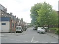
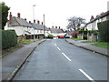
1
Wilfred Avenue - looking towards Cross Green Lane
Image: © Betty Longbottom
Taken: 27 Jan 2015
0.01 miles
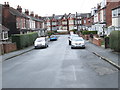
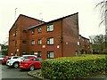
5
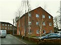
Charlotte Court, Charlotte Grove
A small apartment block.
Image: © Stephen Craven
Taken: 1 Jan 2021
0.05 miles
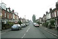
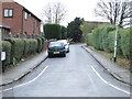
7
Wheaton Court, Primrose Lane
Sheltered housing.
Image: © Stephen Craven
Taken: 1 Jan 2021
0.07 miles
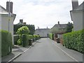
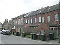
8
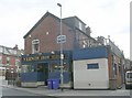
Vernon Bros Tailors - Cross Green Lane
Image: © Betty Longbottom
Taken: 19 May 2010
0.07 miles