IMAGES TAKEN NEAR TO
Carrfield Road, LEEDS, LS15 4JB
Introduction
This page details the photographs taken nearby to Carrfield Road, LS15 4JB by members of the Geograph project.
The Geograph project started in 2005 with the aim of publishing, organising and preserving representative images for every square kilometre of Great Britain, Ireland and the Isle of Man.

There are currently over 7.5m images from over14,400 individuals and you can help contribute to the project by visiting https://www.geograph.org.uk
Image Map
Images are licensed for reuse under creativecommons.org/licenses/by-sa/2.0
Notes
- Clicking on the map will re-center to the selected point.
- The higher the marker number, the further away the image location is from the centre of the postcode.
Image Listing (128 Images Found)
Images are licensed for reuse under creativecommons.org/licenses/by-sa/2.0
Image
Details
Distance
1
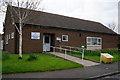
John Rylie House Community Centre
Barwick in Elmet.
Image: © Ian S
Taken: 23 Apr 2014
0.02 miles
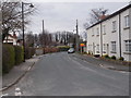
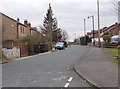
4
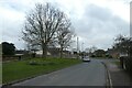
Carrfield Lane
Looking along Carrfield Lane near Carrfield Drive in Barwick in Elmet.
Image: © DS Pugh
Taken: 18 Mar 2023
0.03 miles
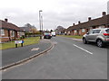
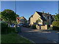
5
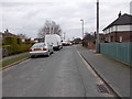
Carrfield Lane - viewed from Carrfield Road
Image: © Betty Longbottom
Taken: 22 Mar 2016
0.05 miles
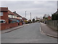
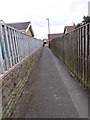
7
Across Elmwood Lane
Elmwood Lane looks to have been recently resurfaced. The road ahead is Carrfield Lane.
Image: © DS Pugh
Taken: 18 Mar 2023
0.08 miles
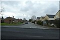
9
The Sycamores, Leeds Road, Barwick-in-Elmet
A modern housing development.
Image: © Stephen Craven
Taken: 8 May 2020
0.08 miles