IMAGES TAKEN NEAR TO
Bishops Way, LEEDS, LS14 6NU
Introduction
This page details the photographs taken nearby to Bishops Way, LS14 6NU by members of the Geograph project.
The Geograph project started in 2005 with the aim of publishing, organising and preserving representative images for every square kilometre of Great Britain, Ireland and the Isle of Man.

There are currently over 7.5m images from over14,400 individuals and you can help contribute to the project by visiting https://www.geograph.org.uk
Image Map
Images are licensed for reuse under creativecommons.org/licenses/by-sa/2.0
Notes
- Clicking on the map will re-center to the selected point.
- The higher the marker number, the further away the image location is from the centre of the postcode.
Image Listing (48 Images Found)
Images are licensed for reuse under creativecommons.org/licenses/by-sa/2.0
Image
Details
Distance
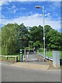
1
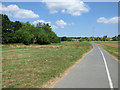
Wykebeck Way at Brooklands
The path runs a short distance away from the beck (among the trees to the left) that gives it its name.
Image: © Stephen Craven
Taken: 7 Jul 2018
0.06 miles
2
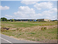
Bishop Young Academy, Seacroft
A co-educational Church of England secondary school in east Leeds, opened in 2006 to replace the former East Leeds High School, it was relaunched in 2017 and renamed after David Young CBE (1931–2008), Bishop of Ripon 1977-1999. Viewed here from the Wykebeck Way.
Image: © Stephen Craven
Taken: 7 Jul 2018
0.07 miles
4
Foundry Mill Gardens - North Parkway
Image: © Betty Longbottom
Taken: 26 May 2014
0.07 miles
5
Arthur's Rein - viewed from North Parkway
Image: © Betty Longbottom
Taken: 26 May 2014
0.08 miles
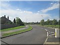
6
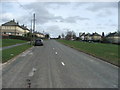
North Parkway.
Seacroft, Leeds. Looking NE.
Image: © Steve Partridge
Taken: 26 Mar 2006
0.09 miles
7
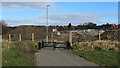
Diversion on the Wyke Beck Green Corridor
Section of the footpath and cycleway, that forms part of a green corridor between Roundhay Park and Rothwell, via Temple Newsam.
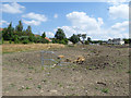
Here it has been recently diverted at Brooklands to allow the building of a housing estate, thus squeezing the confines of the corridor ever tighter.
Image: © Chris Heaton
Taken: 23 Feb 2022
0.09 miles
8
Foxwood Farm Way, off Fearnville Place
Leading to a small housing development between the back gardens and Wyke Beck.
Image: © Christine Johnstone
Taken: 21 Nov 2012
0.13 miles
9
Land drain off Asket Avenue
It looks as if this formerly culverted land drain, a minor tributary of the Wyke Beck, has been recently turned into an open watercourse except for a shorter culvert under the Wykebeck Way.
Image: © Stephen Craven
Taken: 7 Jul 2018
0.13 miles
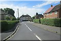
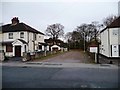
10
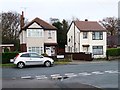
Detached houses with a view up Reinwood Avenue
At the junction of Grange Park Road and Fearnville Place.
Image: © Christine Johnstone
Taken: 21 Nov 2012
0.14 miles