IMAGES TAKEN NEAR TO
St. James Approach, LEEDS, LS14 6JJ
Introduction
This page details the photographs taken nearby to St. James Approach, LS14 6JJ by members of the Geograph project.
The Geograph project started in 2005 with the aim of publishing, organising and preserving representative images for every square kilometre of Great Britain, Ireland and the Isle of Man.

There are currently over 7.5m images from over14,400 individuals and you can help contribute to the project by visiting https://www.geograph.org.uk
Image Map
Images are licensed for reuse under creativecommons.org/licenses/by-sa/2.0
Notes
- Clicking on the map will re-center to the selected point.
- The higher the marker number, the further away the image location is from the centre of the postcode.
Image Listing (112 Images Found)
Images are licensed for reuse under creativecommons.org/licenses/by-sa/2.0
Image
Details
Distance
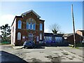
1
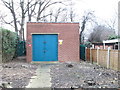
Electricity Substation - St James Approach
Image: © Betty Longbottom
Taken: 10 Feb 2015
0.02 miles
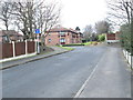
6
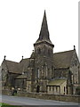
Graveyard - St James Church, Seacroft
Image: © Betty Longbottom
Taken: 10 Feb 2015
0.09 miles

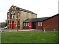
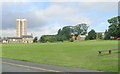
9
Former Wesleyan Methodist chapel, Seacroft
Now an arts centre. The Methodists now meet in the modern building immediately to the right.
Image: © Stephen Craven
Taken: 24 Feb 2024
0.09 miles
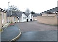
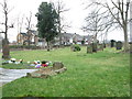
10
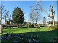
St James, Seacroft: churchyard
The churchyard is long since full (i.e. no modern burials) but has never been formally closed.
Image: © Stephen Craven
Taken: 24 Feb 2024
0.09 miles