IMAGES TAKEN NEAR TO
Foundry Mill Street, LEEDS, LS14 6DB
Introduction
This page details the photographs taken nearby to Foundry Mill Street, LS14 6DB by members of the Geograph project.
The Geograph project started in 2005 with the aim of publishing, organising and preserving representative images for every square kilometre of Great Britain, Ireland and the Isle of Man.

There are currently over 7.5m images from over14,400 individuals and you can help contribute to the project by visiting https://www.geograph.org.uk
Image Map
Images are licensed for reuse under creativecommons.org/licenses/by-sa/2.0
Notes
- Clicking on the map will re-center to the selected point.
- The higher the marker number, the further away the image location is from the centre of the postcode.
Image Listing (63 Images Found)
Images are licensed for reuse under creativecommons.org/licenses/by-sa/2.0
Image
Details
Distance
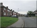
1
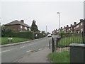
Mardale Crescent - Foundry Mill Street
Image: © Betty Longbottom
Taken: 3 Jun 2014
0.01 miles
2
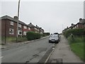
Hawkshead Crescent - Foundry Mill Street
Image: © Betty Longbottom
Taken: 3 Jun 2014
0.06 miles
3
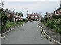
Brathay Gardens - Hawkshead Crescent
Image: © Betty Longbottom
Taken: 3 Jun 2014
0.06 miles
4
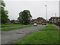
Ironwood Crescent - Foundry Mill Street
Image: © Betty Longbottom
Taken: 3 Jun 2014
0.07 miles
5
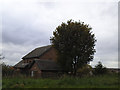
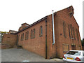
Church of the Ascension, Seacroft: former vicarage
The vicarage was adjacent to the church Image It is no longer in use as such since the church itself is no longer used for Anglican worship and the Rector of the parish is now attached to St Luke'sImage
Image: © Stephen Craven
Taken: 23 Oct 2015
0.07 miles
6
Church of the Assumption - Ironwood Approach, Seacroft
Image: © Betty Longbottom
Taken: 22 Jul 2008
0.07 miles
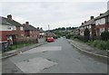
7
Mardale Crescent - Ironwood Approach
Image: © Betty Longbottom
Taken: 3 Jun 2014
0.07 miles
8
Borrowdale Terrace - Hawkshead Crescent
Image: © Betty Longbottom
Taken: 3 Jun 2014
0.08 miles
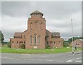
9
Church of the Ascension, Seacroft: west end
The church opened in 1961, originally (and still officially) an Anglican one, but as of 2015 it was being used by the Forward in Faith denomination. There are proposals for it to be sold to them.
The building is actually aligned NW-SE; this is the liturgical west end.
Image: © Stephen Craven
Taken: 23 Oct 2015
0.09 miles
10
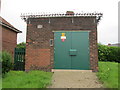
Electricity Substation No 2859 - Ironwood Approach
Image: © Betty Longbottom
Taken: 3 Jun 2014
0.09 miles