IMAGES TAKEN NEAR TO
Stanks Lane North, LEEDS, LS14 5DD
Introduction
This page details the photographs taken nearby to Stanks Lane North, LS14 5DD by members of the Geograph project.
The Geograph project started in 2005 with the aim of publishing, organising and preserving representative images for every square kilometre of Great Britain, Ireland and the Isle of Man.

There are currently over 7.5m images from over14,400 individuals and you can help contribute to the project by visiting https://www.geograph.org.uk
Image Map
Images are licensed for reuse under creativecommons.org/licenses/by-sa/2.0
Notes
- Clicking on the map will re-center to the selected point.
- The higher the marker number, the further away the image location is from the centre of the postcode.
Image Listing (72 Images Found)
Images are licensed for reuse under creativecommons.org/licenses/by-sa/2.0
Image
Details
Distance
1
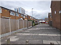
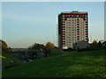
Sherburn Square - Stanks Lane North
Image: © Betty Longbottom
Taken: 22 Jun 2015
0.00 miles
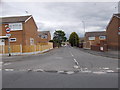
2
Sherburn Approach - Stanks Lane North
Image: © Betty Longbottom
Taken: 22 Jun 2015
0.02 miles
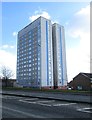
3
Sherburn Place - Stanks Lane North
Image: © Betty Longbottom
Taken: 22 Jun 2015
0.03 miles
4
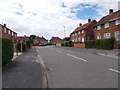
Mill Green Gardens - Stanks Lane North
Image: © Betty Longbottom
Taken: 22 Jun 2015
0.03 miles
6
Mill Green View - Mill Green Gardens
Image: © Betty Longbottom
Taken: 22 Jun 2015
0.08 miles
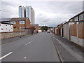
8
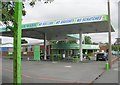
Whinmoor Hand Car Wash - York Road
Image: © Betty Longbottom
Taken: 22 Jul 2008
0.09 miles
9
York Road - viewed from Hebden Path
Image: © Betty Longbottom
Taken: 17 Feb 2015
0.09 miles
10
Mill Green Gardens - viewed from Mill Green Close
Image: © Betty Longbottom
Taken: 22 Jun 2015
0.09 miles