IMAGES TAKEN NEAR TO
Wetherby Road, LEEDS, LS14 3HS
Introduction
This page details the photographs taken nearby to Wetherby Road, LS14 3HS by members of the Geograph project.
The Geograph project started in 2005 with the aim of publishing, organising and preserving representative images for every square kilometre of Great Britain, Ireland and the Isle of Man.

There are currently over 7.5m images from over14,400 individuals and you can help contribute to the project by visiting https://www.geograph.org.uk
Image Map
Images are licensed for reuse under creativecommons.org/licenses/by-sa/2.0
Notes
- Clicking on the map will re-center to the selected point.
- The higher the marker number, the further away the image location is from the centre of the postcode.
Image Listing (13 Images Found)
Images are licensed for reuse under creativecommons.org/licenses/by-sa/2.0
Image
Details
Distance
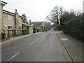
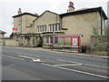
1
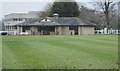
Cricket Pavilion - off Wetherby Road
Image: © Betty Longbottom
Taken: 16 Mar 2015
0.09 miles
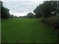
3
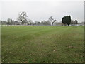
Cricket Ground - off Wetherby Road
Image: © Betty Longbottom
Taken: 16 Mar 2015
0.14 miles
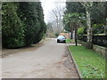
5
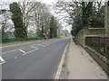
Wetherby Road - viewed from Ling Lane
Image: © Betty Longbottom
Taken: 16 Mar 2015
0.19 miles
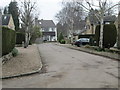
6
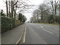
Wetherby Road - viewed from Ling Lane
Image: © Betty Longbottom
Taken: 16 Mar 2015
0.20 miles
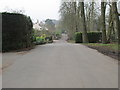
10
Footpath towards Scarcroft Grange
The right of way follows the hedge from Scarcroft Beck towards Scarcroft Grange on the A58 Leeds/Wetherby Road.
Image: © Chris Heaton
Taken: 15 Jul 2009
0.22 miles