IMAGES TAKEN NEAR TO
Carr Lane, LEEDS, LS14 3HG
Introduction
This page details the photographs taken nearby to Carr Lane, LS14 3HG by members of the Geograph project.
The Geograph project started in 2005 with the aim of publishing, organising and preserving representative images for every square kilometre of Great Britain, Ireland and the Isle of Man.

There are currently over 7.5m images from over14,400 individuals and you can help contribute to the project by visiting https://www.geograph.org.uk
Image Map
Images are licensed for reuse under creativecommons.org/licenses/by-sa/2.0
Notes
- Clicking on the map will re-center to the selected point.
- The higher the marker number, the further away the image location is from the centre of the postcode.
Image Listing (9 Images Found)
Images are licensed for reuse under creativecommons.org/licenses/by-sa/2.0
Image
Details
Distance
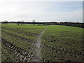
1
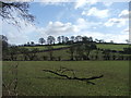
Birkby Grange.
E of Shadwell. Looking SE from Carr Lane.
Image: © Steve Partridge
Taken: 17 Feb 2006
0.07 miles
3
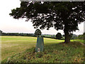
Birkby Hill Ordnance Survey Trig Pillar
Image: © Siobhan Brennan-Raymond
Taken: 21 Aug 2010
0.07 miles
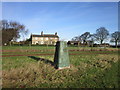
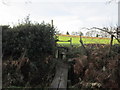
4
A footpath at Birkby Grange
This public right of way as been moved to miss out Birkby Grange
Image: © Ian S
Taken: 28 Jan 2012
0.08 miles
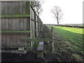
5
A stile near Birkby Grange
My OS map shows a public right of way here. But maybe it as been moved since my OS map was printed.
Image: © Ian S
Taken: 28 Jan 2012
0.10 miles
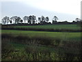
8
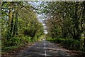
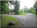
Carr Lane
Section of the road between the A58 at Shadwell and Thorner.
Image: © Chris Heaton
Taken: 9 Apr 2017
0.21 miles