
IMAGES TAKEN NEAR TO
Kensington Avenue, LEEDS, LS14 3EH
Introduction
This page details the photographs taken nearby to Kensington Avenue, LS14 3EH by members of the Geograph project.
The Geograph project started in 2005 with the aim of publishing, organising and preserving representative images for every square kilometre of Great Britain, Ireland and the Isle of Man.

There are currently over 7.5m images from over14,400 individuals and you can help contribute to the project by visiting https://www.geograph.org.uk
Image Map
Images are licensed for reuse under creativecommons.org/licenses/by-sa/2.0
Notes
- Clicking on the map will re-center to the selected point.
- The higher the marker number, the further away the image location is from the centre of the postcode.
Image Listing (72 Images Found)
Images are licensed for reuse under creativecommons.org/licenses/by-sa/2.0
Image
Details
Distance
1
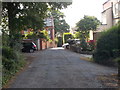
Kensington Avenue - looking towards Bramham Road
Image: © Betty Longbottom
Taken: 17 Aug 2015
0.03 miles
3
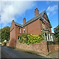
Thorner, 1 Bramham Road
There is a benchmark cut into the gable end of the property and it is to the left of the junction between the garden wall and the house wall.
Image: © Mel Towler
Taken: 7 Oct 2022
0.06 miles
4
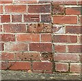
Thorner, 1 Bramham Road
The benchmark is cut into the west face of the property and is cut into the 6th and 7th courses bricks.
Image: © Mel Towler
Taken: 7 Oct 2022
0.06 miles
5
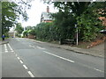
Bench and bus stop, Bramham Road, Thorner
The plaque on the bench reads 'Royal Silver Jubilee / Thorner 1935 / The Nursery Seat'. It commemorates the silver jubilee celebrated for King George the Fifth and Queen Mary. There is a 103 metre spot height at this road junction.
Image: © Christine Johnstone
Taken: 15 Aug 2023
0.07 miles
6
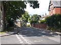
Bramham Road - viewed from Kirkfield Lane
Image: © Betty Longbottom
Taken: 17 Aug 2015
0.07 miles
7
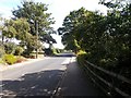
Bramham Road - viewed from Kirklands Lane
Image: © Betty Longbottom
Taken: 17 Aug 2015
0.07 miles
8
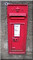
Victorian Post Box - Church Hill, Thorner
Image: © Betty Longbottom
Taken: 3 Sep 2008
0.07 miles
9
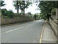
Church Hill, Thorner
Dropping from 103 metres above sea level to 85 metres. The church is at the bottom, not the top.
Image: © Christine Johnstone
Taken: 15 Aug 2023
0.10 miles
10
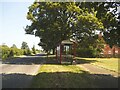
Bus shelter on Bramham Road
Serving Kirkfield Avenue and other residential streets at the east end of Thorner.
Image: © Stephen Craven
Taken: 10 Jun 2023
0.11 miles