IMAGES TAKEN NEAR TO
Stonefield, Thorner Lane, LEEDS, LS14 3AB
Introduction
This page details the photographs taken nearby to Stonefield, Thorner Lane, LS14 3AB by members of the Geograph project.
The Geograph project started in 2005 with the aim of publishing, organising and preserving representative images for every square kilometre of Great Britain, Ireland and the Isle of Man.

There are currently over 7.5m images from over14,400 individuals and you can help contribute to the project by visiting https://www.geograph.org.uk
Image Map
Images are licensed for reuse under creativecommons.org/licenses/by-sa/2.0
Notes
- Clicking on the map will re-center to the selected point.
- The higher the marker number, the further away the image location is from the centre of the postcode.
Image Listing (36 Images Found)
Images are licensed for reuse under creativecommons.org/licenses/by-sa/2.0
Image
Details
Distance
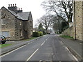
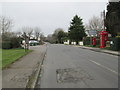
1
Pedestrian crossing, Scarcroft
Crossing the A58 Leeds - Wetherby road at the bus stop.
Image: © Christine Johnstone
Taken: 18 Jul 2012
0.03 miles
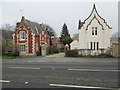
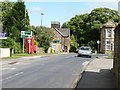
2
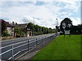
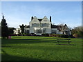
The New Inn, Scarcroft
'Country pub and dining' with extensive grounds.
Image: © Christine Johnstone
Taken: 18 Jul 2012
0.04 miles
4
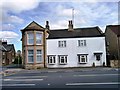
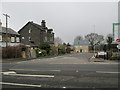
Different architectural styles, Scarcroft
Unmatched neighbours at the A58 crossroads and 91 metre spot height.
Image: © Christine Johnstone
Taken: 18 Jul 2012
0.04 miles
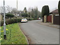
9
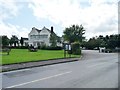
Left for Wetherby, right for Leeds
Syke Lane meets the A58 in Scarcroft.
Image: © Christine Johnstone
Taken: 18 Jul 2012
0.05 miles