IMAGES TAKEN NEAR TO
Coal Road, LS14 1PS
Introduction
This page details the photographs taken nearby to Coal Road, LS14 1PS by members of the Geograph project.
The Geograph project started in 2005 with the aim of publishing, organising and preserving representative images for every square kilometre of Great Britain, Ireland and the Isle of Man.

There are currently over 7.5m images from over14,400 individuals and you can help contribute to the project by visiting https://www.geograph.org.uk
Image Map
Images are licensed for reuse under creativecommons.org/licenses/by-sa/2.0
Notes
- Clicking on the map will re-center to the selected point.
- The higher the marker number, the further away the image location is from the centre of the postcode.
Image Listing (23 Images Found)
Images are licensed for reuse under creativecommons.org/licenses/by-sa/2.0
Image
Details
Distance
1
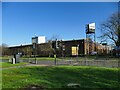
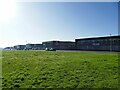
Former AGFA factory, Seacroft
A large industrial building, 2.6 hectares in area. The plant (originally Howson-Algraphy, part of the Vickers empire) was opened by HM Queen Elizabeth II and made lithographic plates, "arguably the leading printing plate production facility in the world" according to one source. It was sold to Agfa in 1999, and employed up to 900 people. In later years the workforce numbered under 100 and it closed in October 2020, presumably as a result of film and journalism going digital. Part of the site was sold for the Hawthorns housing development, but the main factory building remains vacanct as of early 2024.
Image: © Stephen Craven
Taken: 24 Feb 2024
0.08 miles
2
Limewood industrial estate (3)
This building is home to Nederman and Nordfab UK,
Image: © Stephen Craven
Taken: 24 Feb 2024
0.15 miles
4
Limewood industrial estate (1)
This building is home to Erris Homes and Howard Civil Engineering (probably companies in the same group).
Image: © Stephen Craven
Taken: 24 Feb 2024
0.16 miles
6
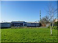
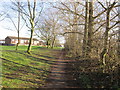
Limewood industrial estate (2)
Various buildings facing the old ring road across a wide strip of grass. These appear on maps as long ago as 1968.
Image: © Stephen Craven
Taken: 24 Feb 2024
0.16 miles
7
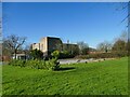
Seacroft Telephone Exchange
Part of the Limewood industrial estate.
Image: © Stephen Craven
Taken: 24 Feb 2024
0.17 miles
9
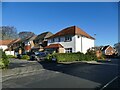
Juniper Court, Seacroft
Part of a modern housing development.
Image: © Stephen Craven
Taken: 24 Feb 2024
0.17 miles
10
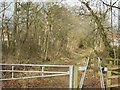
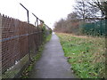
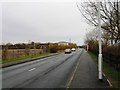
Lane off Coal Road
This lane leads north west off Coal Road, near the junction of Red Hall Vale.
Image: © Rich Tea
Taken: 21 Mar 2006
0.18 miles