IMAGES TAKEN NEAR TO
Coal Road, LEEDS, LS14 1NP
Introduction
This page details the photographs taken nearby to Coal Road, LS14 1NP by members of the Geograph project.
The Geograph project started in 2005 with the aim of publishing, organising and preserving representative images for every square kilometre of Great Britain, Ireland and the Isle of Man.

There are currently over 7.5m images from over14,400 individuals and you can help contribute to the project by visiting https://www.geograph.org.uk
Image Map
Images are licensed for reuse under creativecommons.org/licenses/by-sa/2.0
Notes
- Clicking on the map will re-center to the selected point.
- The higher the marker number, the further away the image location is from the centre of the postcode.
Image Listing (46 Images Found)
Images are licensed for reuse under creativecommons.org/licenses/by-sa/2.0
Image
Details
Distance
1
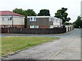
361 -367 Red Hall Croft, Whinmoor
Unlike their neighbours, still flat-roofed.
Image: © Christine Johnstone
Taken: 25 Jul 2012
0.02 miles
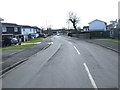
2
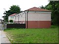
2 - 10 Red Hall Vale, Whinmoor
Unlike the houses opposite, re-clad and re-roofed.
Image: © Christine Johnstone
Taken: 25 Jul 2012
0.02 miles
3
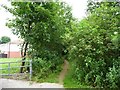
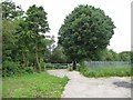
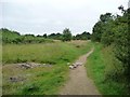
Footpath mapped as Green Lane, Whinmoor
Heading from the corner of Red Hall Croft towards Coal Road.
Image: © Christine Johnstone
Taken: 25 Jul 2012
0.04 miles
4
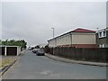
Red Hall Croft, Whinmoor
Parallel, and to the west of, Coal Road. A few of the flat-roofed houses have gained pitched roofs.
Image: © Christine Johnstone
Taken: 25 Jul 2012
0.04 miles
5
Footpath and track off Red Hall Croft
Heading towards the Ringwood estate and the ring road.
Image: © Christine Johnstone
Taken: 25 Jul 2012
0.04 miles
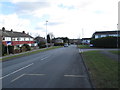
8
Coal Road
Looking north, the road on the left is Red Hall Vale. Coal Road was reputedly built to carry coal from mines at Temple Newsam to Harewood House, both being owned by the Earls of Harewood.
Image: © Rich Tea
Taken: 21 Mar 2006
0.07 miles
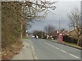
9
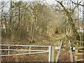
Lane off Coal Road
This lane leads north west off Coal Road, near the junction of Red Hall Vale.
Image: © Rich Tea
Taken: 21 Mar 2006
0.07 miles
10
Footpath mapped as Green Lane
Running northwest from Red Hall Croft.
Image: © Christine Johnstone
Taken: 25 Jul 2012
0.07 miles