
IMAGES TAKEN NEAR TO
Harley Terrace, LEEDS, LS13 4RE
Introduction
This page details the photographs taken nearby to Harley Terrace, LS13 4RE by members of the Geograph project.
The Geograph project started in 2005 with the aim of publishing, organising and preserving representative images for every square kilometre of Great Britain, Ireland and the Isle of Man.

There are currently over 7.5m images from over14,400 individuals and you can help contribute to the project by visiting https://www.geograph.org.uk
Image Map
Images are licensed for reuse under creativecommons.org/licenses/by-sa/2.0
Notes
- Clicking on the map will re-center to the selected point.
- The higher the marker number, the further away the image location is from the centre of the postcode.
Image Listing (179 Images Found)
Images are licensed for reuse under creativecommons.org/licenses/by-sa/2.0
Image
Details
Distance
1
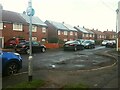
Harley Terrace, Swinnow
Like some other postwar housing estates in Leeds, the roads on this estates are relatively narrow with passing places that are often used as parking areas by inconsiderate residents.
Image: © Stephen Craven
Taken: 23 Jan 2021
0.01 miles
2
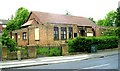
St Mark's Methodist Church - Swinnow Lane
Image: © Betty Longbottom
Taken: 31 May 2007
0.01 miles
3
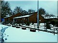
Swinnow Community Centre
It would seem from the path trodden through the snow that community activities continued through the early 2021 Covid-19 lockdown.
Image: © Stephen Craven
Taken: 16 Jan 2021
0.03 miles
4
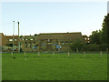
St Mark's Methodist Church, Swinnow Moor
Since Betty Longbottom's photo in 2007 Image the hedge has been removed to make the church more visible. It stands at the top of the Swinnow Moor recreation ground Image
Image: © Stephen Craven
Taken: 27 Aug 2015
0.03 miles
5
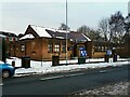
St Mark's Methodist church, Swinnow Lane
The church opened in 1957. See Image for a wider context.
Image: © Stephen Craven
Taken: 16 Jan 2021
0.03 miles
6
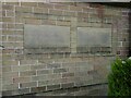
St Mark's Methodist church, Swinnow Lane - dedication stone
The dedication stone was laid by the Rev Dr Harold Roberts, President of the Methodist Conference, on 28 September 1957. The stone to the right was laid by Alderman Joseph Hiley, Lord Mayor of Leeds. See Image for context.
Image: © Stephen Craven
Taken: 16 Jan 2021
0.03 miles
7
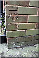
Benchmark on #104 Swinnow Lane
Ordnance Survey cut mark benchmark described on the Bench Mark Database at http://www.bench-marks.org.uk/bm83681
Image: © Roger Templeman
Taken: 11 Apr 2017
0.03 miles
9
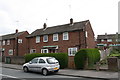
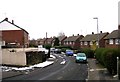
Houses on Swinnow Lane
There is an OS benchmark Image on the side of the right hand house at its front corner
Image: © Roger Templeman
Taken: 11 Apr 2017
0.04 miles
10
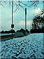
Telecoms mast on Swinnow Lane
The location may have been determined to give mobile coverage to the Leeds Ring Road, as it is on high ground near the centre point of the radius of a 90 degree curve of the road, about 400-500m away.
Image: © Stephen Craven
Taken: 16 Jan 2021
0.04 miles