
IMAGES TAKEN NEAR TO
Queensthorpe Avenue, LEEDS, LS13 4JS
Introduction
This page details the photographs taken nearby to Queensthorpe Avenue, LS13 4JS by members of the Geograph project.
The Geograph project started in 2005 with the aim of publishing, organising and preserving representative images for every square kilometre of Great Britain, Ireland and the Isle of Man.

There are currently over 7.5m images from over14,400 individuals and you can help contribute to the project by visiting https://www.geograph.org.uk
Image Map
Images are licensed for reuse under creativecommons.org/licenses/by-sa/2.0
Notes
- Clicking on the map will re-center to the selected point.
- The higher the marker number, the further away the image location is from the centre of the postcode.
Image Listing (123 Images Found)
Images are licensed for reuse under creativecommons.org/licenses/by-sa/2.0
Image
Details
Distance
1
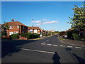
Queensthorpe Avenue
Mostly semi-detached housing on the Gamble Hill estate.
Image: © Stephen Craven
Taken: 24 May 2020
0.04 miles
2
Queensthorpe Avenue - Gamble Hill Drive
Image: © Betty Longbottom
Taken: 10 May 2011
0.04 miles
3
Queensthorpe Rise - Queensthorpe Avenue
Image: © Betty Longbottom
Taken: 10 May 2011
0.04 miles
4
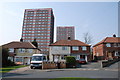
Queensthorpe Rise
The street where I was born, showing semis and the high rise Gamble Hill flats.
Image: © Michael Woodhead
Taken: 28 Mar 2007
0.05 miles
5

Henconner Court
A new gated community off Henconner Lane. Planning application 23/01675/FU was for 'Retention and alterations of existing cottages to form 2 dwellings and 3 No. new build houses with associated landscaping and private drive access road'. At this point the houses were already occupied, with finishing touches being put to the road and landscaping. The converted cottages are to the right, the new houses beyond.
Image: © Stephen Craven
Taken: 10 Jun 2026
0.06 miles
6
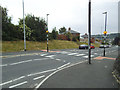
Upper zebra crossing, Henconner Lane
One of two between the railway bridge and Pudsey Road roundabout. This one is close to the junction of Queensthorpe Avenue. This 'humped' crossing is supposed to slow traffic on what is a 30mph road, as well as providing step-free crossing for pedestrians, but not all drivers do slow down.
Image: © Stephen Craven
Taken: 9 Jun 2020
0.06 miles
7
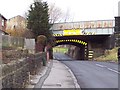
Bridge over Henconner Lane
Leeds/Bradford railway line crossing Henconner Lane, Gamble Hill, Leeds.
Image: © Chris Heaton
Taken: 12 Dec 2005
0.07 miles
8
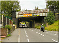
Railway Bridge, Henconner Lane, Bramley
This is a double bridge, as a second pair of tracks had been added by 1908. These have since been taken up, so the steel girder bridge is redundant (although might come in useful eventually).
Image: © Humphrey Bolton
Taken: 22 Sep 2020
0.07 miles
10
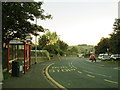
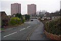
Gamble Hill Drive with bus shelters
This section of the Gamble Hill estate spine road follows the route of an old road called Boggard Lane, of which only the old stone wall to the left of the photo remains. The route of most of the lane has been obliterated by the post-war estate.
Image: © Stephen Craven
Taken: 30 Sep 2015
0.07 miles