
IMAGES TAKEN NEAR TO
Pudsey Road, LEEDS, LS13 4JB
Introduction
This page details the photographs taken nearby to Pudsey Road, LS13 4JB by members of the Geograph project.
The Geograph project started in 2005 with the aim of publishing, organising and preserving representative images for every square kilometre of Great Britain, Ireland and the Isle of Man.

There are currently over 7.5m images from over14,400 individuals and you can help contribute to the project by visiting https://www.geograph.org.uk
Image Map
Images are licensed for reuse under creativecommons.org/licenses/by-sa/2.0
Notes
- Clicking on the map will re-center to the selected point.
- The higher the marker number, the further away the image location is from the centre of the postcode.
Image Listing (128 Images Found)
Images are licensed for reuse under creativecommons.org/licenses/by-sa/2.0
Image
Details
Distance
1
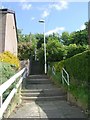
Steps - Pudsey Road to Gamble Hill Drive
Image: © Betty Longbottom
Taken: 10 May 2011
0.00 miles
3
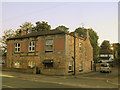
Corn Mill Yard, Pudsey Road
The building shown here is possibly the only old one remaining of what was once an extensive industrial estate including a tannery.
Image: © Stephen Craven
Taken: 30 Sep 2015
0.05 miles
4
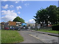
Greenhill Primary School - Gamble Hill Drive
Image: © Betty Longbottom
Taken: 10 May 2011
0.05 miles
5
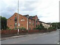
Rear of the Corn Mill Hotel
See Image for the front, facing the ring road. The hotel, or more accurately motel, was built in the 1990s. The restaurant is open to non-residents and specialises in large functions.
Image: © Stephen Craven
Taken: 9 Sep 2022
0.05 miles
7
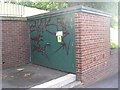
Electricity Substation No 3895 - Gamble Hill Drive
Image: © Betty Longbottom
Taken: 10 May 2011
0.06 miles
8
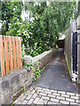
Footbridge over Farnley Beck, near Pudsey Road
The bridge, which was presumably wide enough originally to take vehicles or at least a horse-and-cart, gave access over the beck to Corn Mill Yard (now the site of Hare Farm Avenue).
Image: © Stephen Craven
Taken: 11 Jun 2020
0.07 miles
9
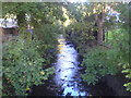
Farnley Beck seen from the bridge between Corn Mill Courts and Hare Farm Close
Image: © Schlosser67
Taken: 2 Oct 2016
0.07 miles
10
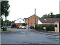
Hare Farm Close
I can't see 'Hare Farm' marked on old maps of the area, though there was a Hare Park Mill nearby.
Image: © Stephen Craven
Taken: 11 Jun 2020
0.07 miles