
IMAGES TAKEN NEAR TO
Rossefield Chase, LEEDS, LS13 3SF
Introduction
This page details the photographs taken nearby to Rossefield Chase, LS13 3SF by members of the Geograph project.
The Geograph project started in 2005 with the aim of publishing, organising and preserving representative images for every square kilometre of Great Britain, Ireland and the Isle of Man.

There are currently over 7.5m images from over14,400 individuals and you can help contribute to the project by visiting https://www.geograph.org.uk
Image Map
Images are licensed for reuse under creativecommons.org/licenses/by-sa/2.0
Notes
- Clicking on the map will re-center to the selected point.
- The higher the marker number, the further away the image location is from the centre of the postcode.
Image Listing (429 Images Found)
Images are licensed for reuse under creativecommons.org/licenses/by-sa/2.0
Image
Details
Distance
1
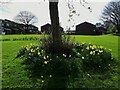
Daffodils on the open space in the centre of Bramley
When the centre of Bramley was redeveloped in the 1970s, this green space was left to the north of the new Rossefield estate, as an extension to the greenery provided by St Peter's churchyard. It was formerly occupied by the buildings around Farrar's Yard and Turner's Yard.
Image: © Stephen Craven
Taken: 2 Apr 2021
0.04 miles
2
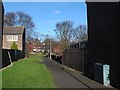
Path from Rossefield Drive to St Peter's churchyard
Image: © Stephen Craven
Taken: 14 Feb 2016
0.04 miles
3
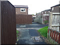
Path junction off Rossefield Drive
This illustrates how the 1980s Rossefield estate, even more than most, is covered with a network of paths that allow people to move through the estate almost completely away from motor traffic. In that respect it was ahead of its time.
Image: © Stephen Craven
Taken: 27 Jun 2020
0.04 miles
4
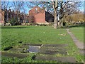
Gravestones laid flat, St Peter's churchyard, Bramley
Some gravestones were re-used as paving stones (right); others probably just laid down where they were (left).
Image: © Stephen Craven
Taken: 14 Feb 2016
0.05 miles
5
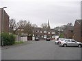
Rossefield Chase - Rossefield Drive
Image: © Betty Longbottom
Taken: 4 Apr 2011
0.05 miles
6
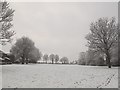
St Peter's churchyard in the snow
About 3cm of snow had fallen overnight.
Image: © Stephen Craven
Taken: 17 Jan 2016
0.05 miles
7
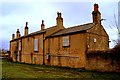
The Old Unicorn Inn, Stocks Hill, Bramley, Leeds
Image: © Mark Stevenson
Taken: 8 Apr 2014
0.05 miles
8
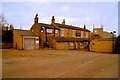
The Old Unicorn Inn, Stocks Hill, Bramley, Leeds
Image: © Mark Stevenson
Taken: 8 Apr 2014
0.05 miles
9
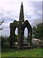
The spire of Bramley St Margaret
This stone edifice, banished to the edge of Bramley St Peter's graveyard, is all that remains of the spire of St Margaret's church. The predecessor to St Peter's was demolished in 1861 and this four column structure supported the spire, which was much taller than now. Lower Town Street runs behind the railings at a much lower level.
Image: © John S Turner
Taken: 13 Jun 2004
0.05 miles
10
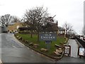
Approach to the Old Unicorn, Bramley
The way in to the pub Image is by a drive to the car park, or (to the right) a cobbled path for pedestrians. The pub re-opened as a Wetherspoon is December 2014.
Image: © Stephen Craven
Taken: 25 Dec 2015
0.05 miles