IMAGES TAKEN NEAR TO
Rossefield Drive, LEEDS, LS13 3RX
Introduction
This page details the photographs taken nearby to Rossefield Drive, LS13 3RX by members of the Geograph project.
The Geograph project started in 2005 with the aim of publishing, organising and preserving representative images for every square kilometre of Great Britain, Ireland and the Isle of Man.

There are currently over 7.5m images from over14,400 individuals and you can help contribute to the project by visiting https://www.geograph.org.uk
Image Map
Images are licensed for reuse under creativecommons.org/licenses/by-sa/2.0
Notes
- Clicking on the map will re-center to the selected point.
- The higher the marker number, the further away the image location is from the centre of the postcode.
Image Listing (476 Images Found)
Images are licensed for reuse under creativecommons.org/licenses/by-sa/2.0
Image
Details
Distance
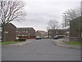
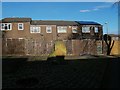
2
Substation and lock-up garages, Rossefield View, Bramley
Image: © Stephen Craven
Taken: 14 Feb 2016
0.04 miles
3
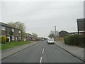
Rossefield Drive - Rossefield Grove
Image: © Betty Longbottom
Taken: 4 Apr 2011
0.04 miles
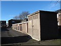
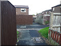
4
Backs of houses on Rossefield View, Bramley
Image: © Stephen Craven
Taken: 14 Feb 2016
0.05 miles
5
Rock, Rossefield View, Bramley
A rock about 1.5 metres high has been set in place at a junction of paths on a modern housing estate. It does not appear from old maps to correspond to any old boundary or feature.
Image: © Stephen Craven
Taken: 14 Feb 2016
0.06 miles
6
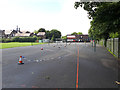
Playground of St Peter's school, Bramley
I hope the 'police incident' tape is for role play purposes and not the sign of a serious incident in the playground.
Image: © Stephen Craven
Taken: 27 Jun 2020
0.06 miles
7
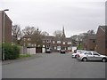
Rossefield Chase - Rossefield Drive
Image: © Betty Longbottom
Taken: 4 Apr 2011
0.06 miles
8
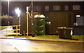
Pop-up polling station on the Rossefield estate
This shipping container was re-purposed for a temporary polling booth on the day of the 2019 general election.
Image: © Stephen Craven
Taken: 12 Dec 2019
0.06 miles
9
Path from Rossefield Drive to St Peter's churchyard
Image: © Stephen Craven
Taken: 14 Feb 2016
0.06 miles
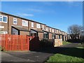
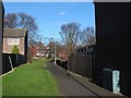
10
Path junction off Rossefield Drive
This illustrates how the 1980s Rossefield estate, even more than most, is covered with a network of paths that allow people to move through the estate almost completely away from motor traffic. In that respect it was ahead of its time.
Image: © Stephen Craven
Taken: 27 Jun 2020
0.06 miles