
IMAGES TAKEN NEAR TO
Stanningley Road, LEEDS, LS13 3QW
Introduction
This page details the photographs taken nearby to Stanningley Road, LS13 3QW by members of the Geograph project.
The Geograph project started in 2005 with the aim of publishing, organising and preserving representative images for every square kilometre of Great Britain, Ireland and the Isle of Man.

There are currently over 7.5m images from over14,400 individuals and you can help contribute to the project by visiting https://www.geograph.org.uk
Image Map
Images are licensed for reuse under creativecommons.org/licenses/by-sa/2.0
Notes
- Clicking on the map will re-center to the selected point.
- The higher the marker number, the further away the image location is from the centre of the postcode.
Image Listing (357 Images Found)
Images are licensed for reuse under creativecommons.org/licenses/by-sa/2.0
Image
Details
Distance
3
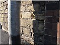
Benchmark on Stanningley Road
For context, the benchmark is behind the lamp post seen in Image An old map gives its level as 370.14ft.
Image: © Stephen Craven
Taken: 6 Sep 2015
0.02 miles
4
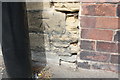
Benchmark on wall on north side of Stanningley Road
Ordnance Survey cut mark benchmark described on the Bench Mark Database at http://www.bench-marks.org.uk/bm83671
Image: © Roger Templeman
Taken: 11 Apr 2017
0.02 miles
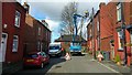
6
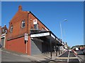
Arcaded shops, Stanningley Road, Bramley
The style of the arcade is reminiscent of (for example) Lord Street, Southport but not as ornate.
Image: © Stephen Craven
Taken: 6 Sep 2015
0.02 miles
7
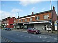
Shops on Stanningley Road, Bramley
See Image for a view from the other end.
Image: © Stephen Craven
Taken: 19 Dec 2020
0.02 miles
8
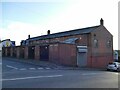
Rear of shops on Stanningley Road, Bramley
See Image for the front. Each shop has a substantial storage unit attached to the rear.
Image: © Stephen Craven
Taken: 19 Dec 2020
0.02 miles
9
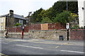
Wall on north side of Stanningley Road west of #340
There is an OS benchmark Image on the stone wall between the lamppost and the junction with the brick boundary wall of #340. The sign on the lamppost says parking or loading on the footway is forbidden
Image: © Roger Templeman
Taken: 11 Apr 2017
0.03 miles
10
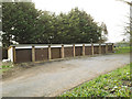
Garages, Station Avenue, Bramley
These "lock-ups" were a 20th century solution to the problem of people living in terraced houses without gardens finding somewhere to park.
Image: © Stephen Craven
Taken: 19 Mar 2020
0.03 miles