
IMAGES TAKEN NEAR TO
Fairfield Terrace, LEEDS, LS13 3DG
Introduction
This page details the photographs taken nearby to Fairfield Terrace, LS13 3DG by members of the Geograph project.
The Geograph project started in 2005 with the aim of publishing, organising and preserving representative images for every square kilometre of Great Britain, Ireland and the Isle of Man.

There are currently over 7.5m images from over14,400 individuals and you can help contribute to the project by visiting https://www.geograph.org.uk
Image Map
Images are licensed for reuse under creativecommons.org/licenses/by-sa/2.0
Notes
- Clicking on the map will re-center to the selected point.
- The higher the marker number, the further away the image location is from the centre of the postcode.
Image Listing (328 Images Found)
Images are licensed for reuse under creativecommons.org/licenses/by-sa/2.0
Image
Details
Distance
1
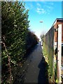
Path into Bramley Park from the Fairfield estate
The path currently runs dead straight between the houses from Rosemont Terrace, crossing Fairfield Terrace (here) and Fairfield Hill. Its origins can be seen on the 1908 map as a field boundary from Stanningley Road all the way up to the top corner of what was then the much smaller Recreation Ground. On the 1965 map, after the Fairfield estate was built, the whole length is shown as a footpath, but the lower part of the estate has since been redeveloped and the section below Rosemont Terrace has been lost as a path.
Image: © Stephen Craven
Taken: 29 Dec 2020
0.02 miles
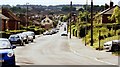
3
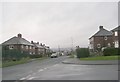
Fairfield Terrace - viewed from Fairfield Hill
Image: © Betty Longbottom
Taken: 19 Jan 2009
0.03 miles
4
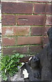
Benchmark on #108 Fairfield Terrace
Ordnance Survey cut mark benchmark described on the Bench Mark Database at http://www.bench-marks.org.uk/bm83670
Image: © Roger Templeman
Taken: 11 Apr 2017
0.04 miles
5
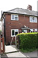
#108 Fairfield Terrace
There is an OS benchmark Image on the front of the house near the left hand corner, left of a small lion statue
Image: © Roger Templeman
Taken: 11 Apr 2017
0.04 miles
6
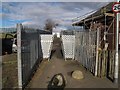
Barriers at an entrance to Bramley Park
The barriers prevent any users other than pedestrians getting into the park from Fairfield Hill. I guess the main intention is to stop youngsters on mopeds.
Image: © Stephen Craven
Taken: 14 Feb 2016
0.05 miles
7
Fairfield Hill - Fairfield Terrace
Image: © Betty Longbottom
Taken: 19 Jan 2009
0.05 miles
8
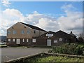
Fairfield Community Centre
Previously known as the Sure Start Centre Image
Image: © Stephen Craven
Taken: 14 Feb 2016
0.05 miles
9
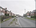
Fairfield Terrace - viewed from Fairfield Hill
Image: © Betty Longbottom
Taken: 19 Jan 2009
0.06 miles
10
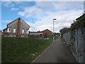
Footpath towards Bramley Park
This path now only starts at Rosemont Terrace part way up the hill, but on older maps is shown as running straight from Stanningley Road over the hill to Upper Town Street. This is the view from Fairfield Street.
Image: © Stephen Craven
Taken: 14 Feb 2016
0.06 miles