IMAGES TAKEN NEAR TO
Wood Lane, LEEDS, LS13 2NS
Introduction
This page details the photographs taken nearby to Wood Lane, LS13 2NS by members of the Geograph project.
The Geograph project started in 2005 with the aim of publishing, organising and preserving representative images for every square kilometre of Great Britain, Ireland and the Isle of Man.

There are currently over 7.5m images from over14,400 individuals and you can help contribute to the project by visiting https://www.geograph.org.uk
Image Map
Images are licensed for reuse under creativecommons.org/licenses/by-sa/2.0
Notes
- Clicking on the map will re-center to the selected point.
- The higher the marker number, the further away the image location is from the centre of the postcode.
Image Listing (214 Images Found)
Images are licensed for reuse under creativecommons.org/licenses/by-sa/2.0
Image
Details
Distance
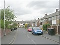
4
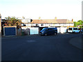
Junction with Wood Lane
Broad Lane in Bramley with Wood Lane to the right.
Image: © DS Pugh
Taken: 14 Sep 2024
0.04 miles
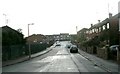
5
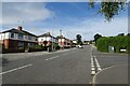
Ganners Lane - viewed from Wellington Grove
Image: © Betty Longbottom
Taken: 13 Apr 2011
0.04 miles
6
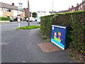
The Owl and the Pussycat
A decorated utility cabinet on the corner of Wood Lane and Ganners Lane. In the background is a bus stop served by the infrequent route 80.
Image: © Stephen Craven
Taken: 17 Jul 2020
0.05 miles
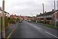
7
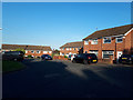
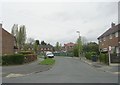
Ganners Close
Newer housing than the rest of the Ganners estate.
Image: © Stephen Craven
Taken: 20 May 2020
0.05 miles
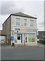
8
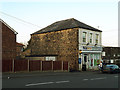
Nisa Local, Broad Lane, Bramley
A convenience store.
Image: © Stephen Craven
Taken: 25 Mar 2020
0.05 miles