
IMAGES TAKEN NEAR TO
Bell Mount View, LEEDS, LS13 2JD
Introduction
This page details the photographs taken nearby to Bell Mount View, LS13 2JD by members of the Geograph project.
The Geograph project started in 2005 with the aim of publishing, organising and preserving representative images for every square kilometre of Great Britain, Ireland and the Isle of Man.

There are currently over 7.5m images from over14,400 individuals and you can help contribute to the project by visiting https://www.geograph.org.uk
Image Map
Images are licensed for reuse under creativecommons.org/licenses/by-sa/2.0
Notes
- Clicking on the map will re-center to the selected point.
- The higher the marker number, the further away the image location is from the centre of the postcode.
Image Listing (410 Images Found)
Images are licensed for reuse under creativecommons.org/licenses/by-sa/2.0
Image
Details
Distance
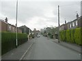

3

Open space above Broad Lane, Bramley
The bottom end of the green space was the site of the former Wellington Mills, see also Image and Image This is the top end.
Image: © Stephen Craven
Taken: 25 Mar 2020
0.05 miles
4
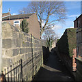
Footpath to Broad Lane
The path runs from Upper Town Street to Broad Lane. The old stone wall gives an idea of its age; it is shown on the 1851 6-inch map as a path running along the western edge of a field, which by the 1933 edition was a cricket ground and now housing, so that it has become an urban ginnel.
Image: © Stephen Craven
Taken: 4 Feb 2017
0.05 miles
5

Watery themed junction box on Bellmount View
Another addition to the street art of Bramley.
Image: © Stephen Craven
Taken: 25 Oct 2020
0.05 miles
6
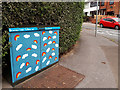
Rainbows and clouds, Waterloo Lane, Bramley
One of Bramley Tate's latest designs using repeated symbols rather then their more usual geometric patterns.
Image: © Stephen Craven
Taken: 14 Jul 2020
0.05 miles
7
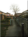
Path towards Town Street, Bramley
The route of this urban footpath from Broad Lane to Upper Town Street predates all the current housing either side; old maps show it running up the side of Wellington Mills and then on this alignment. The bollard probably remains from the previous era.
Image: © Stephen Craven
Taken: 25 Mar 2020
0.05 miles
8

Cherry grove in an open space
There seems to be no official or local name for this green space, though as another contributor points out, there used to be a textile mill here in the early 20th century. There are now several trees including this fine set of mature cherries, planted in a circular grove (not very evident in this photo, but clear from aerial views).
Image: © Stephen Craven
Taken: 19 Aug 2022
0.05 miles
9
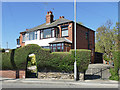
A nice bit of topiary
A thick hedge to the boundary of a property on Waterloo Lane has been cut to form a neat arch around the garden gate.
Image: © Stephen Craven
Taken: 19 Apr 2020
0.06 miles
10
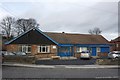
Bramley Community Centre
The Gable End could do with re-painting.
Image: © Richard Kay
Taken: 19 Nov 2009
0.06 miles