
IMAGES TAKEN NEAR TO
Hill Court View, LEEDS, LS13 2HL
Introduction
This page details the photographs taken nearby to Hill Court View, LS13 2HL by members of the Geograph project.
The Geograph project started in 2005 with the aim of publishing, organising and preserving representative images for every square kilometre of Great Britain, Ireland and the Isle of Man.

There are currently over 7.5m images from over14,400 individuals and you can help contribute to the project by visiting https://www.geograph.org.uk
Image Map
Images are licensed for reuse under creativecommons.org/licenses/by-sa/2.0
Notes
- Clicking on the map will re-center to the selected point.
- The higher the marker number, the further away the image location is from the centre of the postcode.
Image Listing (267 Images Found)
Images are licensed for reuse under creativecommons.org/licenses/by-sa/2.0
Image
Details
Distance
2
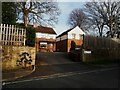
Hill Court Fold, Bramley
Off Hill Court Drive, and a later addition (the 1950s OS map shows Hill Court Drive, but a gap where these houses are now).
Image: © Stephen Craven
Taken: 30 Mar 2021
0.04 miles
3
Hill Court Avenue - Hill Court Drive
Image: © Betty Longbottom
Taken: 13 Apr 2011
0.05 miles
4
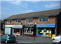
Parade of shops
Situated on Whitecote Hill, Bramley. Where I grew up, not many miles distant, in the 1950s we had a similar row of shops: there was a greengrocer's, a grocer's, a newsagent's and a fish and chip shop. Today in Bramley we see a cleaning services shop, a manicurist's, a hairdresser's and a tanning salon. How times have changed - we now buy our dreams on the doorstep and our food out of town.
Image: © michael ely
Taken: 5 Jul 2006
0.06 miles
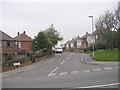
6
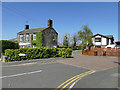
Mount Pleasant, off Whitecote Hill, Bramley
The name originally referred to a court of terraced cottages as shown on the 1908 map, but only the house at the entrance (left) remains; the cottages have been replaced with more modern dwellings and the road is on a new alignment.
Image: © Stephen Craven
Taken: 19 Apr 2020
0.06 miles
7
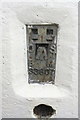
Benchmark on trig point beside the Leeds and Bradford Road
Ordnance Survey flush bracket (identifier S3807) described on the Ordnance Survey Database as: SE23883574 FLUSH BRACKET FL BR S3807 WHITECOTE TP SE SIDE LEEDS AND BRADFORD RD 104.821m above Newlyn Datum
Image: © Roger Templeman
Taken: 18 Apr 2017
0.06 miles
8
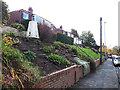
Oddly positioned trig pillar
This trig pillar is situated on top of the embankment of Leeds and Bradford Road. I did wonder whether it was one of those made surplus to requirements by the OS and "liberated" from elsewhere as an ornament, but the 1953 1:25,000 map does show it here with an approximate elevation of 344ft. See also Image
Image: © Stephen Craven
Taken: 3 Nov 2019
0.06 miles
9
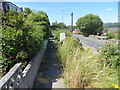
Pathway beside Leeds and Bradford Road (B6157)
Looking south-westward towards Whitecote Triangulation Pillar.
Image: © Peter Wood
Taken: 2 Jul 2018
0.07 miles
10
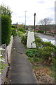
Ordnance Survey triangulation pillar beside Leeds and Bradford Road
There is an OS benchmark Image on the face of the pillar above a sighting hole. See http://trigpointing.uk/trig/6901 for more information.
Image: © Roger Templeman
Taken: 18 Apr 2017
0.07 miles