
IMAGES TAKEN NEAR TO
Coal Hill Drive, LEEDS, LS13 1PA
Introduction
This page details the photographs taken nearby to Coal Hill Drive, LS13 1PA by members of the Geograph project.
The Geograph project started in 2005 with the aim of publishing, organising and preserving representative images for every square kilometre of Great Britain, Ireland and the Isle of Man.

There are currently over 7.5m images from over14,400 individuals and you can help contribute to the project by visiting https://www.geograph.org.uk
Image Map
Images are licensed for reuse under creativecommons.org/licenses/by-sa/2.0
Notes
- Clicking on the map will re-center to the selected point.
- The higher the marker number, the further away the image location is from the centre of the postcode.
Image Listing (205 Images Found)
Images are licensed for reuse under creativecommons.org/licenses/by-sa/2.0
Image
Details
Distance
1
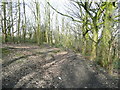
Footpath in the Rodley Park woodland
This is at one of a number of junctions of paths that criss-cross the woodland at the upper end of the park.
Image: © Humphrey Bolton
Taken: 7 Mar 2017
0.03 miles
2
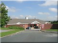
Arthur Miller Stadium - Coal Hill Drive
This is the home of Stanningley Amateur Rugby League Football Club.
Image: © Betty Longbottom
Taken: 24 Jun 2009
0.04 miles
3
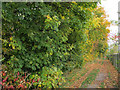
Path behind Valley View school
A footpath linking Coal Hill Drive to the sports pitches at Bagley.
Image: © Stephen Craven
Taken: 25 Oct 2015
0.04 miles
4
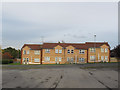
Houses on Coal Hill Drive
The individual external air-conditioning units are unusual for a domestic setting. Perhaps this is sheltered housing or similar?
Image: © Stephen Craven
Taken: 25 Oct 2015
0.05 miles
5
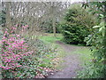
Track leading from Town Street Recreational Ground
Image: © Betty Longbottom
Taken: 5 Apr 2011
0.05 miles
6
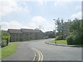
Coal Hill Gardens - Coal Hill Drive
Image: © Betty Longbottom
Taken: 24 Jun 2009
0.05 miles
7
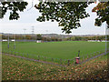
The Arthur Miller Stadium, Bagley
Home of Stanningley Amateur Rugby League Football Club. For the clubhouse see Image Despite the name "stadium" this is an open sports pitch, with no seating area.
Image: © Stephen Craven
Taken: 25 Oct 2015
0.05 miles
8
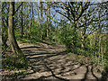
Path junction in the wooded part of Rodley Park
The upper part of the park, or 'Recreation Ground' as it was first known, was laid out with paths zig-zagging up the steep hillside. Over the years this area has developed, intentionally or not into a woodland, but the original paths are still present, as seen here.
Image: © Stephen Craven
Taken: 19 Apr 2020
0.06 miles
10
Tracks leading from Town Street Recreational Ground
Image: © Betty Longbottom
Taken: 5 Apr 2011
0.08 miles