IMAGES TAKEN NEAR TO
Brookfield Avenue, LEEDS, LS13 1NL
Introduction
This page details the photographs taken nearby to Brookfield Avenue, LS13 1NL by members of the Geograph project.
The Geograph project started in 2005 with the aim of publishing, organising and preserving representative images for every square kilometre of Great Britain, Ireland and the Isle of Man.

There are currently over 7.5m images from over14,400 individuals and you can help contribute to the project by visiting https://www.geograph.org.uk
Image Map
Images are licensed for reuse under creativecommons.org/licenses/by-sa/2.0
Notes
- Clicking on the map will re-center to the selected point.
- The higher the marker number, the further away the image location is from the centre of the postcode.
Image Listing (60 Images Found)
Images are licensed for reuse under creativecommons.org/licenses/by-sa/2.0
Image
Details
Distance
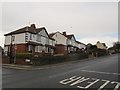
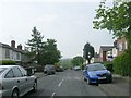
1
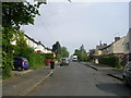
Brookfield Avenue - looking towards Rodley Lane
Image: © Betty Longbottom
Taken: 7 May 2011
0.04 miles
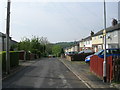
2
Hawthorn Drive - looking towards Rodley Lane
Image: © Betty Longbottom
Taken: 7 May 2011
0.05 miles
3
Hawthorn Drive, Rodley, Leeds
http://www.geograph.org.uk/photo/5109410
Image: © Mark Stevenson
Taken: 6 Jun 2016
0.05 miles
4
Hawthorn Drive, Rodley, Leeds
http://www.geograph.org.uk/photo/5109412
Image: © Mark Stevenson
Taken: 6 Jun 2016
0.05 miles
5
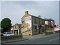
Conservatories, Windows & Doors - Rodley Lane
Image: © Betty Longbottom
Taken: 7 May 2011
0.05 miles
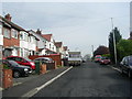
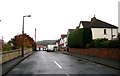
6
Houses on Rodley Lane
Adjacent to Hawthorn Drive. Note the old road sign (A657 - Shipley 5).
Image: © Stephen Craven
Taken: 16 Jan 2016
0.05 miles
7
Brookfield Gardens - Brookfield Avenue
Image: © Betty Longbottom
Taken: 7 May 2011
0.06 miles
8
Hawthorn Drive - Rodley Lane, Rodley
Image: © Betty Longbottom
Taken: 5 Nov 2008
0.06 miles
10
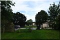
Parking near Brookfield Avenue
Parking near the allotments at Brookfield.
Image: © DS Pugh
Taken: 14 Sep 2024
0.07 miles