
IMAGES TAKEN NEAR TO
Airedale Cliff, LEEDS, LS13 1EA
Introduction
This page details the photographs taken nearby to Airedale Cliff, LS13 1EA by members of the Geograph project.
The Geograph project started in 2005 with the aim of publishing, organising and preserving representative images for every square kilometre of Great Britain, Ireland and the Isle of Man.

There are currently over 7.5m images from over14,400 individuals and you can help contribute to the project by visiting https://www.geograph.org.uk
Image Map
Images are licensed for reuse under creativecommons.org/licenses/by-sa/2.0
Notes
- Clicking on the map will re-center to the selected point.
- The higher the marker number, the further away the image location is from the centre of the postcode.
Image Listing (236 Images Found)
Images are licensed for reuse under creativecommons.org/licenses/by-sa/2.0
Image
Details
Distance
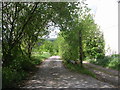
2
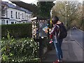
Little Free Library, Pollard Lane
On the corner of Whitecote Lane. The woman here was selecting a picture book for her young child, and gave permission for the photo to be taken.
Image: © Stephen Craven
Taken: 30 Mar 2021
0.01 miles
3
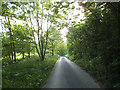
Whitecote Lane (the newer part)
This section of Whitecote Lane linking the older lane to Pollard Lane seems to be relatively new - it has been there at least since 2011 (see Image ) but the Explorer map still dos not show it. I presume it was constructed to improve access to Whitecote House by the canal which otherwise would have had no effective vehicular access.
Image: © Stephen Craven
Taken: 19 May 2018
0.02 miles
4
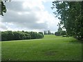
Bramley Fall Park - viewed from Pollard Lane
Image: © Betty Longbottom
Taken: 9 May 2011
0.02 miles
5
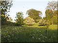
Hawthorn bushes in a field by Whitecote Lane
Image: © Stephen Craven
Taken: 19 May 2018
0.04 miles
6
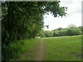
Footpath - from Pollard Lane across Bramley Fall Park
Image: © Betty Longbottom
Taken: 9 May 2011
0.04 miles
8
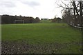
Sports Field on Site of Newlay Quarry
The 1:25000 OS sheet labels the area as Newlay Quarry (dis). The field was very wet with water standing on the surface at the north (lower) end. Insufficient attention to drainage during the quarry backfilling could be the cause.
Image: © Richard Kay
Taken: 19 Nov 2009
0.05 miles
9
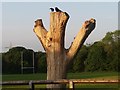
Sunbathing crows
A pair of crows perched on the stump of a dead tree, enjoying early evening sunshine.
Image: © Stephen Craven
Taken: 28 May 2016
0.05 miles
10
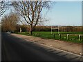
Parking area on Pollard Lane
A surfaced verge that provides parking for the adjacent sports pitches.
Image: © Stephen Craven
Taken: 30 Mar 2021
0.06 miles