IMAGES TAKEN NEAR TO
Blackpool View, LEEDS, LS12 5PE
Introduction
This page details the photographs taken nearby to Blackpool View, LS12 5PE by members of the Geograph project.
The Geograph project started in 2005 with the aim of publishing, organising and preserving representative images for every square kilometre of Great Britain, Ireland and the Isle of Man.

There are currently over 7.5m images from over14,400 individuals and you can help contribute to the project by visiting https://www.geograph.org.uk
Image Map
Images are licensed for reuse under creativecommons.org/licenses/by-sa/2.0
Notes
- Clicking on the map will re-center to the selected point.
- The higher the marker number, the further away the image location is from the centre of the postcode.
Image Listing (155 Images Found)
Images are licensed for reuse under creativecommons.org/licenses/by-sa/2.0
Image
Details
Distance
1
Car park on Cow Close Road (2)
On the site of former back-to-back terraced houses.
Image: © Stephen Craven
Taken: 29 Nov 2020
0.02 miles
2
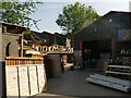
Pavers wooden furniture
Makers of sheds, dog kennels, fencing panels etc.
Image: © Stephen Craven
Taken: 21 May 2020
0.03 miles
3
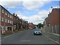
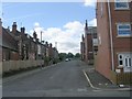
Cow Close Road - viewed from Cobden Street
Image: © Betty Longbottom
Taken: 9 Aug 2011
0.03 miles
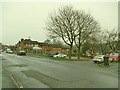
4
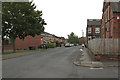
Cow Close Road junction with Cobden Street
The corner of the building to the right of the photograph has a cut bench mark. Bench Mark Database: http://www.bench-marks.org.uk/bm85451
Image: © Mark Anderson
Taken: 14 Jun 2017
0.03 miles
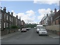
5
Cow Close Road - viewed from Cobden Street
Image: © Betty Longbottom
Taken: 9 Aug 2011
0.04 miles
6
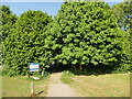
Path from Leeds Ring Road to Granny Lane
The path crosses Wortley Beck in these trees.
Image: © Stephen Craven
Taken: 21 May 2020
0.04 miles
7
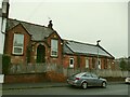
Former church of St Paul, Cow Close Road (1)
Datestones set into the wall of the building give a date (presumably of either start of construction, or opening) of 23 July 1904. The church was known as St Paul's Farnley or sometimes St Paul's, New Blackpool: a daughter church of St Michael & All Angels, Farnley. It was still open for worship according to a report in 1969; I haven't found a definite closure date but the last records at the West Yorkshire Archive Service appear to be in 1978. This view shows the church entrance, now boarded up. It is now in residential use.
Image: © Stephen Craven
Taken: 29 Nov 2020
0.04 miles
8
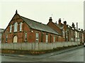
Former church of St Paul, Cow Close Road (2)
Datestones set into the wall of the building give a date (presumably of either start of construction, or opening) of 23 July 1904. The church was known as St Paul's Farnley or sometimes St Paul's, New Blackpool: a daughter church of St Michael & All Angels, Farnley. It was still open for worship according to a report in 1969; I haven't found a definite closure date but the last records at the West Yorkshire Archive Service appear to be in 1978. This view shows the Cobden Avenue side of the church and an adjoining building, perhaps a Sunday school or clergy house. It is now in residential use with solar panels on the roof, which can't have been generating any power on this very dull November day.
Image: © Stephen Craven
Taken: 29 Nov 2020
0.04 miles