IMAGES TAKEN NEAR TO
Armitage Place, LS12 5FD
Introduction
This page details the photographs taken nearby to Armitage Place, LS12 5FD by members of the Geograph project.
The Geograph project started in 2005 with the aim of publishing, organising and preserving representative images for every square kilometre of Great Britain, Ireland and the Isle of Man.

There are currently over 7.5m images from over14,400 individuals and you can help contribute to the project by visiting https://www.geograph.org.uk
Image Map
Images are licensed for reuse under creativecommons.org/licenses/by-sa/2.0
Notes
- Clicking on the map will re-center to the selected point.
- The higher the marker number, the further away the image location is from the centre of the postcode.
Image Listing (68 Images Found)
Images are licensed for reuse under creativecommons.org/licenses/by-sa/2.0
Image
Details
Distance
1
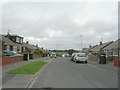
Castle Ings Gardens - looking towards Low Moor Side
Image: © Betty Longbottom
Taken: 16 May 2011
0.08 miles
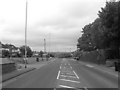
2

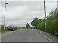
Bus shelter on Whitehall Road
The houses on this section of the main road are set well back from it on a service road.
Image: © Stephen Craven
Taken: 18 Apr 2022
0.08 miles
3
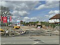
Entrance to Whitehall Grange
A new 'greenfield' housing development off Whitehall Road, for the construction of which a public footpath has been extinguished.
Image: © Stephen Craven
Taken: 18 Apr 2022
0.08 miles
4
Whitehall Road - viewed from Walsh Lane
Image: © Betty Longbottom
Taken: 16 May 2011
0.09 miles
6
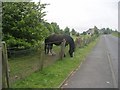
Horse grazing - Low Moor Side Lane
Defying a barbed wire fence, this horse proves that the grass is greener on the other side!
Image: © Betty Longbottom
Taken: 16 May 2011
0.10 miles
7
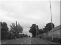
Whitehall Road - viewed from Walsh Lane
Image: © Betty Longbottom
Taken: 16 May 2011
0.11 miles
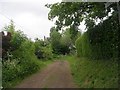
8
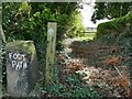
Footpath sign near Wentworth Farm
This somewhat overgrown section of footpath is so difficult to find that even though I was following the Explorer map I missed the painted sign at first, only coming back after finding a locked gate with a 'no footpath' sign a little further on.
Image: © Stephen Craven
Taken: 18 Apr 2022
0.11 miles
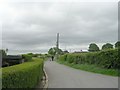
10
Low Moor Side Lane - viewed from Walsh Lane
Image: © Betty Longbottom
Taken: 16 May 2011
0.12 miles