IMAGES TAKEN NEAR TO
Whincover Gardens, LEEDS, LS12 5DA
Introduction
This page details the photographs taken nearby to Whincover Gardens, LS12 5DA by members of the Geograph project.
The Geograph project started in 2005 with the aim of publishing, organising and preserving representative images for every square kilometre of Great Britain, Ireland and the Isle of Man.

There are currently over 7.5m images from over14,400 individuals and you can help contribute to the project by visiting https://www.geograph.org.uk
Image Map
Images are licensed for reuse under creativecommons.org/licenses/by-sa/2.0
Notes
- Clicking on the map will re-center to the selected point.
- The higher the marker number, the further away the image location is from the centre of the postcode.
Image Listing (60 Images Found)
Images are licensed for reuse under creativecommons.org/licenses/by-sa/2.0
Image
Details
Distance
1
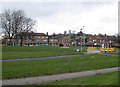
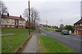
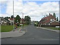
Housing, Farnley
A suburb of southwest Leeds lying west of the ring road and Wortley Beck (or Farnley Beck, depending on which map you are using.)
Image: © Pauline E
Taken: 24 Mar 2010
0.03 miles
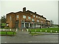
2
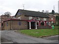
The Butterbowl, Farnley
A 1960s estate pub that boasts a five-a-side football pitch in the beer garden. The name comes from a nearby mill Image
Image: © Stephen Craven
Taken: 29 Nov 2020
0.05 miles
5
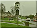
Sign for The Butterbowl, Farnley
See Image for the pub itself. Taken on a very dull late November day - even a bit of post-processing hasn't done much to help the contrast.
Image: © Stephen Craven
Taken: 29 Nov 2020
0.06 miles
6
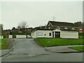
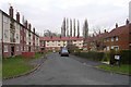
Shops on Butterbowl Drive, Farnley
The row of shops on this 1960s estate was built partly on the site of buildings of Cow Close Farm which gave its name to other local roads.
Image: © Stephen Craven
Taken: 29 Nov 2020
0.08 miles
8
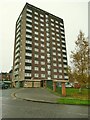
Whincover Grange, Farnley
The UK Housing Wiki entry for "tower blocks in Leeds" doesn't include this 12-storey block, but the Historic England 'Pastscape' database gives the date of planning permission as 1965; curiously it has a 'monument number' (1507041).
Image: © Stephen Craven
Taken: 29 Nov 2020
0.09 miles
10
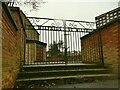
Gates to St Wilfrid's church, Farnley
The Wikipedia entry for "list of places of worship in Leeds" says that since 2015 the church has been St Mary’s Syro-Malabar Catholic Mission.
Image: © Stephen Craven
Taken: 29 Nov 2020
0.11 miles