IMAGES TAKEN NEAR TO
Butt Lane, LEEDS, LS12 5AZ
Introduction
This page details the photographs taken nearby to Butt Lane, LS12 5AZ by members of the Geograph project.
The Geograph project started in 2005 with the aim of publishing, organising and preserving representative images for every square kilometre of Great Britain, Ireland and the Isle of Man.

There are currently over 7.5m images from over14,400 individuals and you can help contribute to the project by visiting https://www.geograph.org.uk
Image Map
Images are licensed for reuse under creativecommons.org/licenses/by-sa/2.0
Notes
- Clicking on the map will re-center to the selected point.
- The higher the marker number, the further away the image location is from the centre of the postcode.
Image Listing (116 Images Found)
Images are licensed for reuse under creativecommons.org/licenses/by-sa/2.0
Image
Details
Distance
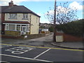
1
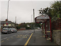
Bus stop on Butt Lane
With a shelter and bus times display screen.
Image: © Stephen Craven
Taken: 18 Oct 2015
0.02 miles
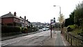
4
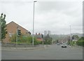
Junction of Water Lane and Butt Lane
Spot the linguistic connection - probably a coincidence.
Image: © Stephen Craven
Taken: 5 Apr 2020
0.05 miles
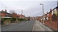
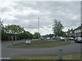
5
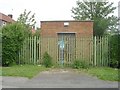
Farnley Water Pumping Station - Tong Approach
Image: © Betty Longbottom
Taken: 17 May 2011
0.05 miles
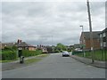
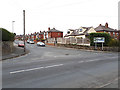
6
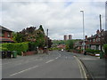
Butt Lane - viewed from Tong Approach
Image: © Betty Longbottom
Taken: 10 May 2011
0.05 miles